
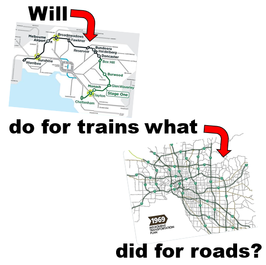
The Suburban Rail Loop is probably public transport's nearest equivalent. Maps showing the full loop were released right at the start; decades before all parts will be built or funded. SRL presents a vision of easy mobility by fast orbital rail that transforms travel from our current old-fashioned infrequent and entirely CBD-centric radially-based trains.
Yes, a good map makes money appear. No doubt to the chagrin of Treasury officials with other ideas.
I'd also argue that if your plan doesn't have a map then it's not really a plan. That observation could be levelled at Victoria's Bus Plan released over a year ago. That gives a good diagnosis of existing problems but lacks a map showing a future upgraded bus network. It thus risks falling into obscurity.
In contrast, Melbourne's previous bus plan, 2006's Meeting our Transport Challenges, had two major maps that related to buses. Let's look at them and see what got done.
SmartBus Stages 1, 2 & 3
What's a SmartBus? It's been described as many things but its key feature was more frequent service and longer operating hours than typical for buses in Melbourne. Oh and save the date; August 5, 2022 is SmartBus' 20th birthday.
SmartBus started as two pilot routes in the eastern suburbs. Its success led to a wider roll-out. The March 2006 SmartBus network map (MOTC p37) showed the four proposed orbitals and some other existing or committed SmartBuses. At that time SmartBus was running on Springvale, Blackburn and Warrigal roads with Wellington Road about to start (as a substitute for Rowville trains).

SmartBus expansion was to be delivered in four stages. Stage 1 included completing routes 900 on Wellington and 901 on Stud between Frankston and Ringwood. Stage 2 included the 903 red orbital west from Box Hill, 902 green orbital to Airport West and the 901 yellow orbital from Ringwood to Melbourne Airport.
Both Stages 1 and 2 were completed. The 901 was revised in the north-east (to reduce but not eliminate some wasteful overlap with 902) and west (to connect Melbourne Airport to Broadmeadows). All this was done just before the 2010 election along with Doncaster's 905, 906, 907 & 908. Like the Wellington Rd 900, these DART freeway SmartBuses were a wider catchment substitute for trains. While DART was denied the opening fanfare seen with new stations or even level crossing removals it has since proved successful.
Stage 3 included adding the blue orbital (904) and extending the green orbital from Airport West to Werribee. Neither happened.
The 904 blue orbital was dropped from the 2008 Victorian Transport Plan (map on p100) in favour of DART and a shift more generally from bus to the increasingly politically troublesome rail. Only the 904's Footscray to Clifton Hill portion was really necessary anyway as the Clifton Hill - Punt Rd section already had the frequent 246 to Elsternwick. The Sandringham and Williamstown ends were either not needed or low priority for a SmartBus.
As for Werribee's green orbital, that made the map in the 2008 plan but got dropped soon after. Some of its alignment got new and upgraded local routes but service hours and weekday frequency remain inferior to SmartBus.
A 2008 Age article said that SmartBus would grow to 370km of routes by 2012. If you counted mostly ex-government routes that offered SmartBus equivalent service (eg 200/207, 216, 220, 223, 234, 246, 250/251, 302/304, 732) then the total length of premium service corridors would be close to 450 km. That's assuming you count the half-SmartBus 703.
SmartBus Stage 4
The 'Future Needs' section of the 2006 MOTC plan maps the 'Principal Public Transport Network' (p14). This map is multimodal, showing trains, trams and main bus routes (ie current or future SmartBuses). Much of the map is unclear, showing corridors and not routes. It represents longer term thinking than SmartBus Stages 1 to 3 discussed above. However given it was made over 16 years ago it's reasonable to ask what parts had been implemented by 2022 (click below for clearer view).

Page 36 says that 'Stage 4 will complete the SmartBus network of more than 900km of cross-town connections. Full details will be provided following the completion of further assessments'. In other words Stage 4 would have been huge, approximately doubling our high service network and providing many more feeders to and between trains.
Where did these routes go? Here are my best guesses, working anticlockwise from south-east to west. Termini may be different and there WILL be omissions and errors especially where there's overlaps.
1. Outer south

A. Frankston - Rosebud. Similar to inner part of Route 788. Recently got a frequency upgrade but not to PPTN/SmartBus standards.
B. Frankston - Cranbourne - Narre Warren - Fountain Gate. Similar to Routes 791 and part of 841. Route 791 got a frequency upgrade when the Cranbourne network was upgraded a few years ago. Pedestrian catchment along parts of the 841 isn't very good but upgrades would improve connections between some of the biggest centres in the south-east (which have grown significantly since 2006).
C. Frankston - Dandenong - Ringwood - Melbourne Airport. The 901 orbital SmartBus. See notes before.
D. Frankston - Ringwood via Eastlink. Presumably a freeway express bus. No equivalent existing route. May or may not deviate to serve Dandenong.
E. Pakenham - Berwick - Fountain Gate - Doveton - Dandenong via Princes Hwy. Similar to existing 926 and most of eastern part of 828. Currently low service levels, particularly on 926 portion and on weekends. Much development in the area is centred on the highway rather than the railway with much growth and in-fill since 2006.
F. Dandenong - Keysborough - Cheltenham - Southland - Sandringham. Similar to western portion of existing 828 except for direct Bay Rd connection to Sandringham. The latter has assumed renewed significance given we now have a station at Southland and the Suburban Rail Loop will start there. The route also has more jobs along it than in 2006 (eg DFO shopping) and resident demographics in Keysborough and Doveton would welcome an upgraded service.
G. Fountain Gate - Endeavour Hills - Noble Park - Southland - Moorabbin - Brighton Beach - Brighton. Largely a Heatherton Rd east-west route. No equivalent but parts of 861, 811 and 821. Much of Heatherton Rd has only the hourly 811 currently. Areas like Harrisfield that 811 traverses need much better service such that a SmartBus would provide. Area swung greatly against Labor in 2022 federal election.
See below for other routes on above map - but in more detail
2. South-east

H. Chelsea - Edithvale - Springvale - Glen Waverley - Nunawading - Airport West - Werribee. The 902 orbital SmartBus. See notes above. Note the dotted line on Thames Prm indicating a potential alternative route via Chelsea Heights. The unbuilt portion west of Airport West would have run along parts of some existing routes like 476 through Keilor to Watergardens and 420 south to Deer Park.
I. Mordialloc - Mentone - Oakleigh - Box Hill - Heidelberg - Coburg - Sunshine - Altona. The 903 orbital SmartBus. See notes above. If you look at a later map the route appears not to go via Buckley St Essendon like it did in the SmartBus map (and now does).
J. Southland - Moorabbin - Elsternwick. A Nepean Hwy route that never happened. Would have spanned a missing gap in the network. Parts served by the limited service Route 823. Route may have been longer and extend north from Elsternwick - hard to tell from map.
K. Dandenong - Princes Hwy - Oakleigh - Chadstone. Existing Route 800. Serves a major corridor with dense new development (eg M-City) and low income residential catchment but currently limited hours with sparse Saturday service and no Sunday trips. Weekends and later evening services would be the highest priority for an upgrade.
L. Stud Park - Wellington Rd - Oakleigh - Chadstone - Caulfield. Existing SmartBus 900 which started in 2006 as a replacement for promised Rowville railway. One of the most productive SmartBus routes. High need for improved weekend frequency due to Chadstone shopper traffic.
M. Brighton - Bentleigh - Clayton - Monash - Blackburn Rd - Blackburn. Existing Route 703. The Clayton - Blackburn portion was one of the original SmartBuses from 2002. Unlike all the others it was never upgraded to full SmartBus operating hours though it got a weekend upgrade a few years ago. Its weekday timetable also has large gaps well exceeding SmartBus' 15 minute maximum wait. Hence it's sort of a 'Cinderella' SmartBus that got neglected while others were rolled out.
N. Elsternwick - Gardenvale - Ormond - Huntingdale - Monash. Basically existing Route 630, the North Rd bus. The maps is unclear but there is scope for it to have been run to Stud Park with the Route 900 not added but instead replaced by an upgraded Route 800 extended to Caulfield (see K and L above).
O. Brighton - Elsternwick - Hotham St - Prahran - Alfred Hospital - CBD. Not clear from map where this goes but portion may be similar to current 603 and previous 200-series routes into the CBD. These routes had frequent service and long operating hours though usage was low. Route 603 retains long operating hours. Also see AH below.
P. Elsternwick - Pt Ormond - Punt Rd - Richmond - Hoddle St - Clifton Hill. Existing Route 246. Long operating hours and more frequent than a SmartBus, hence it qualifies despite never being branded as one.
Q. Clayton - Mt Waverley - Box Hill. Busiest part of existing Route 733. A very productive bus route only every 30 - 60 min most times though 2022 State Budget has funded an upgrade. One of the routes in the east most deserving of an upgrade to SmartBus it is also the route that is most like parts of the Suburban Rail Loop.
3. East

R. Oakleigh - Brandon Park - Ferntree Gully Rd - Boronia. Similar to existing Route 693 but different eastern terminus (though this is a guess). May or may not continue north.
S. Box Hill - Deakin University - Burwood Hwy - Vermont South - Burwood Hwy - Knox City - Burwood Hwy - Upper Ferntree Gully. Similar to existing Route 732. Parts served with a frequent shuttle from Route 75 tram terminus to Knox City. It is possible that this route gets shortened to start at Vermont South due to overlap with the tram.
T. Knox City - Boronia - Croydon - Maroondah Hwy - Chirnside Park - Lilydale. Sort of a hybrid comprising the eastern part of the 737 and Maroondah Hwy's 670. Would have provided a SmartBus to a large part of the outer east with limited bus connectivity. Currently no SmartBuses run east of Stud Rd.
U. Box Hill - Laburnum - Canterbury Rd - Forest Hill Chase - Canterbury Rd - Ringwood. No existing equivalent as existing routes in the area are indirect. But would provide a fast and efficient service of a part of a grid with no continuous bus and connect to two major centres and Forest Hill Chase. PTUA has advocated for a Canterbury Rd SmartBus in the past.
V. Caulfield - Burke Rd - Camberwell - Burke Rd - Heidelberg - La Trobe University - Reservoir. This route does not currently exist. The nearest equivalent service (on different roads) is part of the 624 and 548. Both are every 30 - 60 minutes. Others have suggested Burke Rd tram extensions. Whatever mode is chosen a premium service here will fill a major network gap. It is possibly one of the highest patronage potential corridors discussed here due to all the trains and trams it intersects with. This will include Metro Tunnel and Melbourne Airport Rail in the future.
4. North-east

W. City - Eastern Freeway - Doncaster Rd - Mitcham. Similar to existing SmartBus 907.
X. City - Kew - Doncaster Rd - Doncaster Shoppingtown. Similar to existing Route 207. Has long operating hours, and over the overlap with 200, high frequency as well.
Y. City - King St - The Pines. Similar to existing SmartBus 908. A later change commenced it at Doncaster Park & Ride with a connection to Route 907.
Z. South Morang - Mernda (potential network option). Undecided on mode at the time but eventually got built as heavy rail. Red line nearby is the Epping - South Morang TrainLink bus.
AA. Epping - Wollert (potential network option). Undecided on mode. Took many years for bus services to be upgraded in this fast-growing area.
AB. Clifton Hill - Heidelberg Rd - Fairfield - Station St - Albert St - Northland - La Trobe University. No current route but most like part of existing 567. May start in CBD instead of Clifton Hill. A potentially useful corridor through an area without rail though some might argue whether it should connect to the south via Chandler Hwy to plug a large area with no north-south links.
AC. Heidelberg - Ivanhoe - Northcote - Brunswick - Moonee Ponds. Appears most like existing Route 508 but with an eastern extension. Potentially strong connection across the inner north intersecting numerous trains and trams. Another high priority route. Proposed 904 blue orbital would have provided another east-west route but further south. This appears not to be on this map.
5. West

AD. City - Fishermans Bend - West Gate Bridge - Blackshaws Rd - Altona Gate - Laverton Station (unclear). Somewhat like existing 232 but extends further west. The 232 is not now a strong patronage performer. This one is also likely to be quiet unless there is significant development at Fishermans Bend (which would need a route like this to the west, especially if it fed trains at Newport).
AE. Melbourne Airport - Sunshine (potential network option). Mode not specified at the time. The government has since announced that this alignment will be served by rail. However scope remains to run a bus in the interim to plug a significant 'hole' in the network.
AF. Keilor - Keilor Plains - Taylors Rd - Delahey Village. A short and unclear route not fully served by any existing service. Map may have intended for it to go further west along Taylors Rd to Caroline Springs Town Centre similar to existing Route 418. Keilor is weak as a terminus but an extension east would overlap other routes.
AG. Sydenham (Watergardens) - Melton Hwy - Woodgrove Shopping Centre - Melton Station. Route does not currently exist. Much of area not developed with most of growth nearer freeway. Map also shows a Station Rd route in Melton.
AH. City - Footscray - Sunshine. Similar to existing Route 220 alignment in the west with long hours and frequent service. A SmartBus in all but name. It's possible that it extended south to the Gardenvale/Brighton area like the 216/219/220 routes of the time - see Route O above.
AI. Footscray - Sunshine - Ballarat Rd - Caroline Springs. Similar to 216 and current 426 but some different alignments. May originate in CBD like existing 216 or continue from south - see Route O above.
AJ. Watergardens - Gourlay Rd - Caroline Springs Bvd - Christies Rd - Palmers Rd - Point Cook. Route unclear and predates Caroline Springs Station, Regional Rail Link and Williams Landing Station in area. Northern part follows Route 460 with southern part being industrial and (now) part residential. A north-south route like this is probably desirable but it's arguable whether its likely usage profile justifies it being a long hours SmartBus.
AK. Williamstown - Kororoit Creek Rd - Altona - Laverton - Queen St - Seabrook - Point Cook - Sneydes Rd - Werribee. Eastern part of route is existing 415 and parts follow 498 but otherwise no existing route like it. Likely based on faster development of Werribee East. East-west connections from Point Cook to the Werribee or Werribee Plaza area remain desirable today. However Kororoit Rd is unlikely to support a frequent bus.
AL. Williamstown - Williamstown Rd - Footscray. Similar to part of existing 472. Probably continues past Footscray to Highpoint as part of proposed 904 blue orbital.
AM. Highpoint - Ashley St - Tottenham - Altona Gate. Map unclear but no existing route like it. However has potential as it connects a densely populated area of Maribyrnong to its nearest station. It may extend to North Essendon.
Note: Above map does not show Buckley St Essendon as a PPTN corridor despite the Red Orbital (903) operating along it.
Conclusion
SmartBus Stage 4 would have transformed Melbourne's public transport network if it was implemented on anything like the 30 plus routes listed above. To quote from Page 14, "Completion of the PPTN will make public transport increasingly relevant and attractive to the extensive and growing market for suburban travel".
On the other hand some routes would likely not have performed well while other gaps that may have had more demand were left unfilled. This map does look like a 'first cut' join-the-dots exercise. MOTC confirms that it was indicative and that there would be refinement after later assessments.
SmartBus was conceived under the Kennett government but implemented under the Bracks premiership. Roll-out reached peak speed under his successor John Brumby in 2010 after which it stopped. We got some warning of this with plans being scaled back from 2008. No new SmartBus routes have commenced under the Baillieu, Napthine and Andrews governments.
Should the roll-out of SmartBus or like services, with their longer operating hours and higher frequencies, resume? Let me know in the comments below.
See other Building Melbourne's Useful Network items here
No comments:
Post a Comment