Friday, March 29, 2019

More network pruning - how have we done since 2010?

Two weeks ago I asked whether we could make our bus network more frequent and efficient by pruning bus routes in areas where they overlap or provide service beyond what an area needs.

It was only later that I unearthed a very similar post from November 2010. It was written just before a state election defeat for Labor and victory for the Liberal/National coalition. Discontent with the increasingly crowded and unreliable rail network and the troubled myki ticketing system contributed to Labor's loss. However the Coalition lasted just a single term with Labor returning in 2014. 

Background


Philosophically, Liberals like low taxes, smaller government, economic efficiency, private provision and self-help. Urban Liberals like Malcolm Turnbull and Gladys Berejiklian value public transport as a utility to be run efficiently with maximum patronage. Labor followers, driven by 'fairness', often stress the social importance of  services governments fund. They accept high per-capita subsidies for disadvantaged groups. Buses, in particular, are seen as community services. 

National Party supporters lean towards the Labor view for services in their own rural constituencies, especially if, like country rail upgrades, they can be sold as promoting regional development. If Liberals and Nationals are too far apart then coalitions (often required to govern) can split. Whereas if they are seen as too close then rural National voters may swing to protectionist minor parties or local independents. We saw this in 1999 when a rural backlash against the 'city-centric' Kennett government (which closed country hospitals, schools and railways) ushered in more than a decade of Labor rule, initially assisted by rural independents.

Before losing office in 2010, state Labor had just rolled out the impressive Smartbus orbital and DART services. However these new routes were often layered over the top of existing unchanged routes. This kept things sweet for users of existing routes but was horribly inefficient. It was this duplication, along with the unnecessary operation of SmartBus through sparsely populated areas, that kept SmartBus frequency lower than it should have been, especially on weekends. Passengers sometimes got left behind on busier sections of SmartBus, despite spare buses sitting in depots.

Strengthening strong routes of demonstrated high patronage is something that efficiency-minded Coalition governments can embrace. Especially with rail modes most costs are fixed. Up to the point where more rolling stock needs to be purchased, adding services is relatively cheap, just requiring some extra operational expenditure. It may even be possible to do this in a cost neutral fashion if offsetting cost savings can be found.

While it was most known for service reductions elsewhere, the Kennett goverment actually increased off-peak rail frequencies on the Dandenong and Frankston lines from 20 to 15 minutes. Later it greatly boosted daytime Sunday train and tram frequencies network wide. This century's Baillieu/Napthine Coalition government rolled out 10 minute daytime frequencies on busy rail lines in the south and east. And the recently re-elected NSW Coalition government introduced 7 day 15 minute train frequencies to most stations in Sydney.

Recent history of bus service planning

Getting back to Melbourne and buses, the Baillieu government signed a cut-price bus franchise contract with Transdev in 2013, taking over from National Bus and Melbourne Bus Link. Transdev routes include Melbourne's busiest and most frequent bus routes including DART (Doncaster Area) and orbital SmartBuses. Transdev's contract featured an obligation to introduce a more efficient 'greenfields' bus network.

Transdev simplified some of its routes in 2014. However the major greenfield changes, including splitting the orbitals and increasing frequency on busy portions on them, were to happen in April 2015. There was little public consultation and the network included service cuts on other busy routes. Meanwhile Labor had regained office and vetoed the 2015 network. Things turned from bad to worse with a major fleet maintenance crisis leading to Transdev Melbourne's contract extension being cut short.

While the Transdev network had good features, the cuts to busy routes in areas like Footscray were poorly conceived. On balance the minister was right to reject them. Even from a pure efficiency point of view it didn't completely make sense as service would have remained high in some low-patronage areas. And the single operator based approach to service planning would not have cut the duplication necessary to deliver an efficient network. Routes run by different operators would still have overlapped and timetable changes would have occurred independently rather than in concert. 

There was more success with non-Transdev routes planned by PTV. Reformed bus networks were introduced to Point Cook in 2013, Brimbank in 2014, Geelong and Wyndham in 2015, and Epping North, Plenty Valley and Cranbourne in 2016. Existing bus routes were deleted or radically straightened, coverage was increased and timetables scheduled to match trains.  Often there was a two tier network, with more frequent corridors operating every 20 minutes and local routes on a 40 minute frequency. This gave more people access to a direct bus route operating every 20 minutes or better.

Most of the above was planned under the 2010 - 2014 coalition government. While the 2014 - 2018  Labor government added bus service kilometres, it wasn't very interested in comprehensive network reform despite its wider benefits. This may have been driven by fear since the government had only a slim parliamentary majority in 2014 with many marginal seats. In such an environment it might have been thought politically unwise to upset 1000 passengers with a revised bus network even if it meant denying service improvements to 10 000 others.

Not making public transport as useful as it can be costs patronage. We've seen this in Melbourne with sluggish bus usage rates.
PTV measures usage but appears to lack a strong patronage goal and could do better at network marketing. Last year Labor was re-elected with an increased majority. There is also a new transport minister. It's too early to know whether these events will renew government interest in good bus network planning.  

Review

So much for the context. Let's review my 2010 'dead wood' route list to see what, if any, has been pruned or reformed.

219 (portion): Part west of Sunshine duplicates 903. A weekend variation serves areas covered by Route 471.
* Extension remains but in simpler 7-day form. Weekend variation removed. 

246 (Latrobe Uni extension): Overlaps with other routes between Clifton Hill and Latrobe Uni.
* Extension deleted. 

280/282 (portion): A local route that duplicates the 901 SmartBus along a low-density residential area (Foote St/Reynolds Rd Templestowe).
* No change

286 (entire route): 
Largely duplicated by two SmartBus routes (901 and 906) along Blackburn Rd
* Route deleted. Issues with Route 906 peak crowding. 

293 (part):
 Duplicated by new SmartBus Route between Doncaster Shoppingtown and Eltham (Main Rd roundabout).
* No change.

295: 
Duplicates 903 along Station St between Box Hill and Doncaster Shoppingtown.

* Extension deleted.

340/350: Overlaps with 250 between Ivanhoe and Latrobe Uni.
* Simplified to operate as 350 only. Peak service only. 

445 (part route): Duplicates other routes between Werribee Plaza and Hoppers Crossing Station. Truncation could allow removal of stopping restrictions (including to a local shopping centre) which lessen legibility.
* Reformed in 2014. Replaced by more frequent and direct services in 2015 Wyndham network.

478/479 (part route): Duplicates Route 477 and tram between Moonee Ponds and Airport West.
* Route shortened to remove duplication. Frequency increased. 

479 (City – Moonee Ponds portion): A weekend extension that duplicated by a frequent tram service.
* Weekend extension removed. 

483 (entire route): Freeway service for Sunbury. Will become less necessary after rail electrification.
* No change. 

500 (entire route): Duplicates 901 between Broadmeadows and Melbourne Airport. Duplicates 479 between Melbourne Airport and Sunbury.
* Route deleted.

544 (part route): Duplicates 901 between Roxburgh Park and Broadmeadows
* Route shortened to start at Roxburgh Park.

563 (part route): Duplicates tram along a large section of Plenty Rd and 901 between Greensborough & Plenty Valley SC
* Route deleted in network reform. New route 382 retains substantial overlap with tram. 

623 (part route): Duplicates 626 and 900 between Chadstone SC and Carnegie. Scope for rerouting along Neerim Rd to replace portion of 624.
* No change. 

673 (entire route): An hourly service entirely duplicated by parallel longer routes
* No change.

691 (part route): Monash Uni extension – duplicates direct high-service 900 SmartBus
* Extension deleted. 

694 (entire route): Largely parallels 663 the extended 688 for all but a few stops.
* No change

745 (entire route): Four occasional routes with very low patronage
* No change. 

777 (entire route): A short route with few services and trip generators
* No change

Results

Overlap deleted: 9/20 (45%)
Overlap modified: 3/20 (15%)
No change: 8/20 (40%)

Conclusion

Bus reform can happen. 45% of routes identified as being duplicative were removed within 10  years. A further 15% were modified in local area network reviews. Not as high as it could be but still encouraging. Opportunities remain to seek efficiencies with the remaining 40%. And that excludes any new or uncommented on overlaps such as discussed here.

You might enjoy these well-regarded books on transport topics

Better Buses, Better Cities: How to Plan, Run, and Win the Fight for Effective Transit Steven Higashide NEW!

The Public City: Essays in honour of Paul Mees Gleeson & Beza

A Political Economy of Access: Infrastructure, Networks, Cities, Institutions (Access Quintet Book 4) David Levinson

Human Transit: How Clearer Thinking about Public Transit Can Enrich Our Communities and Our Lives Jarrett Walker

Transport for Suburbia: Beyond the Automobile Age Paul Mees

(Sales links: I get a small commission if you buy via the above - no extra cost to you)

Tuesday, March 26, 2019

Timetable Tuesday #16: Route 410 - Hourly via Churchill

The most important factor that determines the usefulness of a public transport service is not whether it's a train, tram or bus but its timetable, route and stops.

The Footscray / Sunshine area includes some of Melbourne’s busiest bus routes. This is due to several factors.  The most important of these include (i) a long history of frequent 7 day bus service (itself a legacy of the Footscray tram network and subsequent government operation), (ii) grid streets with fairly high residential densities, (iii) favourable demographics including low car ownership and (iv) trains that only skirt the edge of the residential area and operate less frequently than buses.

Four east-west routes run between Sunshine and Footscray.  Three (216, 219, 220) are ex-government routes extending to Melbourne CBD until late at night Monday to Sunday (the latter a rarity that not even SmartBus routes feature).  The other, route 410, is a privately-operated service terminating at Footscray.  This is what we will feature today. 


Compared to some others featured, route 410 is fairly simple. Its only complexity is the Churchill Av deviation showed in the dotted line above.  This deviation runs hourly during the day, Monday to Saturday. Because it overlaps Route 408, it does not add coverage. However it provides Churchill Av with an occasional direct service to Footscray Hospital and station.

You can see how 410 fits in with other routes on the map below.  Only about one-third of it offers unique coverage. Parts overlap Route 220 along Ballarat Rd.  The overlap is due to more routes than parallel through roads existing in the section west of Duke St (216/219, 220, 408, 410 via Ballarat, Churchill, South).  


What about Route 410’s timetable? Its operating hours broadly reflect the minimum service standards introduced about a decade ago.  But more than most other routes frequencies abruptly vary throughout the day and over the week.  This is a consequence of the hourly minimum standard being applied to a route that, when it ran, operated more frequently.  In contrast the 200-series routes have longer operating hours, more even frequencies and no deviations.

The weekday timetable is below. 410’s off-peak daytime headway is 15 minutes. This means it does not harmonise with trains, which at Sunshine, operate every 20 minutes.  Footscray receives many more trains, with these operating on 10 and 20 minute patterns.  Peak frequency is approximately every 12 or 13 minutes.  Weeknight frequencies drop smoothly from 15 to 20 to 30 minutes.

The hourly Churchill Avenue deviation operates between approximately 10 and 6pm.  This causes 410 frequencies on part of Ballarat Rd to be an uneven 15-30-15 minute pattern as the ‘missing’ bus is serving Churchill Avenue instead.  While some might regard 15 minutes as a turn-up-and-go frequency, this service level does not apply along the whole route due to the deviation.  Consequently if one wanted to make a frequent network map only part of the route would be eligible for inclusion.  


Saturday daytime frequencies are an even 20 minutes. This harmonises with Saturday train frequencies (every 20 minutes on all lines).  The hourly Churchill Avenue deviation means that 410 trips on Ballarat Rd follow a 20-40-20 minute pattern.  

Unlike on weeknights, route 410 on Saturdays has no smooth frequency transition in the early evening. Instead it drops abruptly from 20 to 60 minutes before 7pm.  While demand drops at night compared to during the day, it is unlikely that it has fallen by so much in such a sort amount of time.  


Sunday service is a flat 60 minute frequency, ie the minimum standard.  The Sunday service is one-quarter the weekday service and one-third the service on Saturday.  410’s Sunday cut is a sharper cut than SmartBuses (half as frequent on weekends as weekdays) and local trains (mostly 20 minute frequency 7 days).  As mentioned before this reduction is likely because it is the application of the minimum standard to a more frequent Monday – Saturday route that did not previously operate on Sundays. 


What would you do with the 410? Should the hourly Churchill Av deviation be scrapped to simplify the route? Or would it be better if all trips were run via Churchill Av to provide a connection to Footscray? Is there scope to merge 410 with other east-west routes in the Braybrook/Sunshine area and upgrade frequencies on each to 10 minutes to provide turn-up-and-go service?  Or would you retain 410 as is given it is quite popular?  And if the latter do you consider that the hourly Saturday evening and Sunday frequency fairly reflects demand given the route’s Monday – Saturday daytime service?

See other Timetable Tuesday items here 

Friday, March 22, 2019

Unpicking Melbourne's Principal Public Transport Network

One of the tools intended to guide land use planning in Melbourne is the Principal Public Transport Network (PPTN). It's basically the set of rail, tram and major bus corridors that are (or will be) served by high quality service.

While 'high quality public transport' is not defined, common ingredients include fast and direct routes, long operating hours and high frequency day and night. That is service useful enough for people with a choice to use it instead of driving.

There is a symbiotic relationship between the PPTN and land use. Having transit-supportive land uses around PPTN stops encourages patronage growth and further service improvements in a virtuous spiral. Once service becomes competitive, car use and then ownership falls, with people walking, cycling, using public transport or car sharing instead. Businesses on the PPTN gain from increased customer catchment populations, a wider labour pool and turnover growth not limited by parking spaces.   

In contrast, very low densities around frequent public transport routes limits usage despite the good service. That's important because, at least until transit is driverless, frequency is expensive to provide. Whereas the greater the density clustered around PPTN network stops the more jobs and homes benefit and the higher the patronage will be. This has external benefits such as cleaner, more walkable and space-efficient cities less dependent on fossil fuels. 

The PPTN was the centrepiece of the Melbourne 2030 plan of the early 2000s. Plan initiatives included higher densities around activity centres linked by high quality public transport. Public transport's mode share would more than double (to 20% of motorised trips). And sprawl would be limited with an urban growth boundary (that subsequently got expanded).  A 2004 version of the PPTN appears in Linking Melbourne and (less clearly) below. Trains and trams were to provide high capacity radial travel while PPTN buses link suburbs to complement and feed radial rail.  


Little was publicly heard of the PPTN for several years. Unlike other cities we had not communicated it as an easy to use frequent network. Instead we treated all bus routes the same, whether they were an occasional shopper service or a major route that does a tram's job through a dense area.   

However, with little fanfare, the PPTN returned in 2017 via Plan Melbourne. It's an incorporated document, meaning it must be considered when making planning decisions and the minister must authorise amendments. More on the new PPTN here.


The new PPTN is above. It's changed since 2004. For example the PPTN bus network has been removed from areas where it would have been quite marginal, eg the industrial area between Laverton and Sunshine.  However it reflects network reforms over the last 10 years in certain areas, particularly in the north and west. It's viewable as a pdf (which needs to be zoomed to see poorly rendered PPTN bus termini like Werribee, Chelsea and Frankston) or embedded in a mapping tool with a choice of base images.  

Service standards


Before commenting on the PPTN maps we need to know PPTN's service standards. I couldn't find it in Plan MelbourneThe earlier PPTN was based on SmartBus services every 15 minutes on weekdays and 30 minutes on weekends. Neither of these matches the now more widespread 10 and 20 minute train frequencies. 30 minute weekend service is unattractive. And even a 15 minute frequency isn't sufficient in big cities with congested traffic. So, consistent with movement we've seen on train timetables, a real multimodal PPTN should be more frequent. Perhaps every 10 minutes for most of the day, with a 20 minute frequency during quiet times.  

A higher frequency standard makes the PPTN better but smaller. Routes barely good enough for PPTN every 15 minutes wouldn't qualify for a PPTN every 10 minutes or better. Instead you might make it a strong non-PPTN route every 20 minutes with wide operating hours. Later comments about routes that are considered weak inclusions in the PPTN should be read in this context. 

Review by area

The remainder of this post will look at the PPTN network, moving from west to east. Is there enough of it? Or too much? Does it reflect existing practice rather than what's best for the future? And are there corridors that should have PPTN service while it's an extravagance to have it on others?

A proper analysis would explore tram extensions, train service upgrades and buses. However today I will only review buses as these are the PPTN's most changeable and contestable element. They shouldn't be if intended to guide long-term planning. Although that makes it even more important that the PPTN is soundly based. Is it? Thoughts on that later. 

Melbourne West


 Starting at Werribee, the PPTN includes existing routes 170, 180 and 190. These operate between two train lines, and in 170's case, serve a major mid-route trip generator (Werribee Plaza/Pacific Werribee). On weekdays all three routes run at train frequencies (mostly every 20 minutes). 190 also features long operating hours due to its planned connections with trains to and from Geelong. These routes, along with the 495 mentioned later, are less than six years old, having been delivered as part of new bus and train networks in the area. 

While the map features an employment cluster at East Werribee, there are no PPTN bus routes to support it. That's growing, although the major proposed development there has stalled

Neither is there a direct PPTN route between Tarneit and Williams Landing Station (eg existing Route 150). Should there be? While there is a significant residential population remote from rail, Route 150 lacks the big mid-route trip generators you see on SmartBus routes in the eastern suburbs or even the 170 mentioned before.  Are such attractors a requirement for a route to make it on to the PPTN? As you'll see later the answer is 'it varies'. 

Point Cook's PPTN route is the existing Route 495. It serves the Point Cook Town Centre and a residential catchment that provides heavy peak travel demand, with an 11 minute am peak frequency offered.  There are few other all-day trip generators and, unlike most of the routes in Werribee that run between stations, its southern terminus is weak. Interpeak frequency is currently 40 minutes - well below PPTN standards. Although it should get better peak service, longer operating hours and possibly become a twenty minuter, I'm not sure if 495 has the makings of a strong PPTN route. 

Further east, between Footscray, Sunshine, Altona and Laverton is a Y-shaped corridor formed by the existing 411/412 and 903. We discussed the substantial service duplication in this area here. A consistently frequent service along the 411 corridor isn't a bad thing. Existing weekday service (as measured by buses per hour) along Millers Rd already exceeds what a 10 minute PPTN frequency would require. One might debate its need between Altona and Laverton, but, like Point Cook, Altona Meadows has a big population remote from a train station. Higher peak frequency, longer hours and upgraded weekend frequency (currently every 40 minutes) may be greater need than a more frequent weekday interpeak service (currently 20 minutes on 411/412). While there may be small-scale infill development opportunities in Altona Meadows, the location does not strike me as being suitable for large-scale job and residential intensification as it's not on the way to anywhere. 

A theme that should exist with the PPTN is to match transit-oriented land use with high quality public transport service. If there is a mismatch then one would expect plans to change either land use or transport service so they do reconcile. That appears not to have been followed in the Brooklyn area, which, due to being on the 903 SmartBus orbital, remains on the PPTN despite its unsupportive (for public transport) low-density industrial land use. 

What about Williamstown? Its PPTN bus route runs largely parallels the railway to Footscray via Newport. It starts at a quiet backwater and misses the shops at Williamstown. On the plus side it provides some unique coverage in Kingsville and serves a densifying area full of CBD workers. But does it justify PPTN status? Possibly not. It seems to get there by being an existing route (472) that features a 15 minute weekday frequency.

What have the Brooklyn and Williamstown examples illustrated? They appear to show some biases within the PPTN. That is a preference towards existing routes and alignments over potentially stronger corridors and future needs. Which does not seem a good idea for a planning document. 

Melton is easy to discuss since, despite having a massive projected population, it has no PPTN bus routes. This is notwithstanding a proposed town centre at Toolern/Cobblebank. Consequently the PPTN appears to be more an established suburb rather than growth suburb thing.  This is despite (i) the higher population density in outer suburbs due to smaller blocks, (ii) likely higher trip generation rates in growth areas due to high labour force and education participation rates and (iii) the potential for transport routes to shape development before it happens. Working against Melton is that, unlike the Werribee - Tarneit area, there are no direct routes that immediately jump out as being plausible PPTN material. Melton shows that if an area hasn't had a recent bus network review implemented, with direct routes created, it is unlikely to have PPTN corridors. 

The Sunshine - Deer Park - Caroline Springs area PPTN comprises routes 420, 460 and the 426/456 corridor. These are all products of recent local bus network revamps. All provide roughly a 20 minute daytime frequency. They are the sort of direct routes that one would expect on a PPTN, although the 426/456 overlap has a weak terminus due to the routes splitting and the frequency halving. 

The PPTN around Footscray and Sunshine looks much like existing major routes. Its density reflects historical high (15 min) weekday service frequencies. Route alignments included include 216/219, 220, 410 and 903. The main difference is that Churchill Av is on the PPTN even though it is only served by the 408 (which isn't PPTN) and by a once per hour deviation on the 410 (which is). 

North of Footscray appears to be a simplified service to Highpoint and further north via the 406. This is a strong route serving an area remote from trains. The 223 remains around Yarraville, despite its proximity to the train and 472 (discussed before). A historic remnant of the Footscray tram system, the 223 contributes little unique coverage to the network yet remains a frequent service with long operating hours. Again it's worth asking whether this is PPTN material. 

Further north at Essendon the mostly overlapping 903 and 465 alignments feature on the PPTN. The 903 loops around to Sunshine while the 465 retains a weak northern terminus (although the map doesn't show the Keilor Park loop). This brings us to a practical difficulty if anyone ever wanted to implement a network based on the PPTN map. Because it's based on corridors and not routes there is a geometrical problem where a corridor splits into two. Do you have two frequent routes with a forced interchange? Or is it better to have overlapping services with frequency lowered on outer portions? The answer will vary, but in hindsight it might have been better if the PPTN was more practically oriented and defined routes rather than corridors. In Essendon's case the opportunity was not taken to reshape the PPTN, solve a geometrical problem and provide a corridor to Highpoint to give the 903 a more useful purpose on its way to Sunshine via Churchill Avenue (already in PPTN).

Melbourne North


This map will be familiar to those who have looked at a SmartBus orbital network map. Because the 901, 902 and 903 orbitals are mostly still there. The main exception is the deleted South Morang to Greensborough section of the 901. This is a sensible removal.  The rural catchment (around Yarrambat) never did support a frequent SmartBus service and it is unlikely that locals would want the level of urbanisation that would make it so. Bus services to the area are best run with local routes coordinated with trains, which long SmartBus orbitals operating at unharmonised frequencies could never reliably do.

Key PPTN additions are north and south of South Morang Station. North to near Hawkstowe Station and south to the 86 tram terminus. Both sensible additions. A 7-day 20 minute frequency is already in place on routes 386/387 thanks to a bus network revamp a few years ago that simplified routes and improved peak services.

Greensborough has been (over?)fortunate with two SmartBuses. So has Fitzsimons Lane, when other north-south corridors to the west (eg Chandler Hwy) have none. Despite the pruning of the South Morang connection there appear to still be two PPTN corridors approaching from the south-east. This appears excessive given there is also a roughly parallel train line and the area does not strike me being suitable for large-scale densification.

There are what appear to be some PPTN network gaps. Craigieburn and further north, despite high growth, high usage of existing buses, a new town centre remote from the station and suggestions for Aitken Bvd to have bus lanes, has no PPTN corridors.

The LaTrobe cluster also has limited bus PPTN access. There is already a strong service to the south (Route 250 - every 20 minutes with long operating hours). Route 561 provides east west access between Pascoe Vale and Macleod. However only the La Trobe University to Reservoir portion of the 561 is included in the PPTN. This leaves a significant gap between Reservoir and Coburg, and also between Bundoora and Greensborough and/or Macleod.

Melbourne East


This should again be a familiar map that (mostly) replicates current services. It is here that has Melbourne's biggest concentrations of SmartBus services. Especially in the City of Manningham, the PPTN is far finer grained here than anywhere else due to four DART routes to the CBD and all three orbitals intersecting. 

I cannot see anything that has been removed. Low density Warrandyte, because it currently has a SmartBus, remains on the PPTN. Even though its locals are unlikely to be enthusiastic about increased density. And if one is to do density properly, one must be not just on one PPTN route but several to allow widespread mobility and low car dependence.

Where has PPTN been added? Most notable is Route 732 along Burwood Hwy. That currently provides a frequent all-day service over a short section, between the end of the 75 tram and Knox City Shopping Centre. Full length lower frequency trips operate from Box Hill to Upper Ferntree Gully, with some even extending to the hospital there. Even that minor extension is now PPTN according to the map. 

There are other significant additions. For example up Burke Rd across the Yarra to Ivanhoe. That would fill a major gap in the current network. Route 630 across from Elwood (existing weak terminus remaining) along North Rd to Monash University also gets added.

Where are the PPTN 'might have beens'? Access from the Monash precinct to the north remains a problem. Despite current high patronage, routes 733 (Clayton - Box Hill portion), 737 (Monash - Glen Waverley - Knox City portion) and 767 (Chadstone - Deakin - Box Hill portion) do not feature. These are some of Melbourne's busiest bus routes to some of its top trip generators.  Their only crime is that since they were not designated 'SmartBus' or only run every 30 minutes off-peak they were not included, regardless of current usage or future potential. 

There is no PPTN link between the end of the 48 tram and Doncaster Shoppingtown. Neither were Camberwell and Caulfield connected, if only to assuage the desires of those who'd like a Burke Rd tram extension. And, unlike the case with the 472, just because a route runs every 15 minutes is no guarantee that it gets on the PPTN. The 670 between Ringwood, Chirnside Park and Lilydale (twice the train's frequency), for example, doesn't rate. Some have liked to see the Route 900 SmartBus extended eastwards from Stud Park to Ferntree Gully. This would improve connectivity towards the train. However it would have no major intermediate trip generators and hasn't been included.

Melbourne South


The PPTN gets sparser in the south compared to the east. The three SmartBus orbitals are clearly visible. Though you will need to look at the more detailed zoomable map to clearly see the termini of the orbitals at Chelsea and Frankston. 

There are some welcome additions compared to current services. One is a north-south route down East Boundary and Chesterville roads terminating at Southland (like a straighter 822). This fills a large gap between the Frankston line and the Warrigal Rd SmartBus (903). The even spacing puts a large swathe of people within 800 metres of a PPTN service route. Oddly the corridor starts at North Road whereas if it was an actual bus route it would likely keep going north to Murrumbeena Station and Chadstone.

Also notable is the east-west corridor from Dandenong to Sandringham. This is roughly the 828 until Southland. But from there instead of going indirectly to Hampton it runs directly via Bay Rd to Sandringham. Or at least that's how I would have it if a single route. The 828 serves several rail lines, shopping centres and a large area remote from rail. Current weekday frequency is 20 minutes, with an infrequent weekend service. Arguably, like the current 828, the corridor could extend further east to take in at least Doveton, which while it lacks major trip generators, has demographic characteristics favourable for all-day ridership.

Thirdly there's Frankston to Narre Warren (though curiously, not Fountain Gate). This is provided for with the existing 791 to Cranbourne and 841 further north. Current services meet minimum standards but would need increased span and frequency to qualify for PPTN status, especially on the 841 portion. 

What isn't on the PPTN? There's nothing past Frankston. This is even though the 788 was a PPTN route in the previous PPTN. Overlapping routes out to Mornington provide a (roughly) 20 minute corridor but don't feature. Cranbourne area routes like 893 (a major north-south route) and shorter local ones to the east aren't included. Many of these were created or straightened during the 2016 Cranbourne area network revision and operate at 20 minute frequencies Monday to Sunday. Their span is shorter than SmartBus but their weekend daytime frequency is normally higher (20 vs 30 minutes).

I'm in two minds about whether you would include these on the PPTN. Few if any of the above would likely justify a 10 minute frequency, at least off-peak. And from a planning perspective having too many possibilities when locating trip generators may spread them out too much and lessen opportunities for desired clusterings.

Melbourne Inner


Melbourne's inner is dominated by trains and trams so I'll keep it short. Familiar inclusions include corridors that already have frequent routes, such as the 234 (to Port Melbourne), 402 (Footscray - East Melbourne), 250/251 to the north, 216/219/220 to the west, 200/207 to the east and 246 (Punt Rd) are included. Along with the Doncaster routes also to the east. 

The most notable PPTN addition is Route 506 between Moonee Ponds and Brunswick East. This is an east-west route through a densely populated area with low car ownership. You will note how close the PPTN map follows the actual bus route, including what appears to be the unnecessary historical dog-leg that slows buses to avoid a tram overlap. 

The main PPTN map deletions are 216/219/220 to the east towards Prahran via St Kilda Rd. These are historic high frequency and long hours routes. However they operate in an area with a fairly complete tram and train network and are much quieter than the western halves of these routes. 

Could there be more PPTN connections in the CBD and inner city area? East-west routes in the inner north would provide a genuine grid network in conjunction with existing north-south trains and trams.  It's off the map but there's nothing for the potential growth area (and employment cluster) of Fishermans Bend. Connectivity from Parkville to the Clifton Hill group of lines to the east is another possibility. Although if it was a service like the existing Route 401 from North Melbourne it would only be a frequent weekday service and not a 7-day PPTN corridor. 

Conclusion

This has been a quick trip around Melbourne's PPTN corridors. PPTN stands for Principal Public Transport Network. In other words only some corridors get a guernsey. But those that earn it should receive an excellent service, including long operating hours and frequent service. In return, land uses are sufficiently intensive and supportive to guarantee high around the clock patronage to make the investment in service worthwhile.  A program to upgrade bus service levels on PPTN routes, similar to SmartBus a decade ago, but with more frequent service, would make buses more attractive and better used. 

The main predictor of whether a corridor is likely to be on the PPTN network or not is whether it is occupied by an existing SmartBus or other route with a 15 minute or better weekday frequency (mostly ex-tramways board routes). In addition some 20 minute corridors have been added, particularly if they been the products of recent bus network reviews in areas like Werribee, Sunshine, Caroline Springs, South Morang and Cranbourne.  Like the SmartBus orbitals, PPTN bus routes are most likely to be between approximately 10 and 30 km from the CBD, with growth areas missing out. 

Some sections of routes considered marginal nevertheless made it. These include poorly used sections of SmartBus, routes with little unique coverage and one or two odd dog-legs, extensions and tram remnants. It is hoped that these get corrected, and, in the mean time, do not shape important land use decisions. 

Which corridors were least favoured for PPTN purposes? In short, almost any redevelopment or growth area. That goes for both inner brownfields areas (like Fishermans Bend), outer greenfields areas and even some National Employment Clusters. High patronage but non-SmartBus routes in the middle suburbs also didn't make it. 

To summarise, the PPTN map is most useful to support middle suburban land use intensification, drawing heavily on what exists now. It is less applicable for planning near-CBD brownfield or outer suburban greenfield areas with few corridors identified. Also, the PPTN would earn credibility if it defined service standards and was backed by a funded program to achieve them.

You might enjoy these well-regarded books on transport topics

Better Buses, Better Cities: How to Plan, Run, and Win the Fight for Effective Transit Steven Higashide NEW!

The Public City: Essays in honour of Paul Mees Gleeson & Beza

A Political Economy of Access: Infrastructure, Networks, Cities, Institutions (Access Quintet Book 4) David Levinson

Human Transit: How Clearer Thinking about Public Transit Can Enrich Our Communities and Our Lives Jarrett Walker

Transport for Suburbia: Beyond the Automobile Age Paul Mees

(Sales links: I get a small commission if you buy via the above - no extra cost to you)

Tuesday, March 19, 2019

Timetable Tuesday #15: The 2 in 1 Route 279

What has one number, two routes and three destinations?  If you answered one particular Melbourne bus route you’d be correct.  Welcome to Bus 279.  As you’ll find out later it’s one of those bus routes that, despite its sometimes after midnight service, you shouldn’t catch while half asleep.


Route 279 runs between Box Hill and Doncaster Shoppingtown. Except when it doesn’t. For sometimes it goes to Templestowe.  But even if you did want to go from Box Hill to Shoppingtown, you probably wouldn’t catch the 279.  Still, many people catch it for other reasons.  Confused?  Maybe the map below will help.  Or maybe it won’t.  No fear as I’ll explain it all later.


The 279 starts off fairly simple if we go from bottom up. Starting at Box Hill it heads east before going up Middleborough Rd. It’s an established residential area. There aren’t many shops. But if you ride it during peak periods it gets good loadings as a feeder to and from Box Hill. 

The exception is when it deviates via Blackburn. There is a frequent train service between Box Hill and Blackburn. And when the SmartBus orbitals were put in there were new connections between Blackburn and areas to the north.  Still that doesn’t affect what the 279 occasionally does.  That occasional is twice in the morning from Box Hill and twice in the afternoon to Box Hill. 

More significant is what happens further north. Because at King St the bus sometimes turns left then heads south for trips to Doncaster Shoppingtown. At other times it turns right then heads north then west for trips to Templestowe Village.  To make sure you on the right one you need to check both the route number and the destination.  Though the one time I caught it some years ago it was incorrect but the driver of the now empty bus was nice and took me where I intended to go. 


The weekday timetable is below.  While not a SmartBus its weekday service level along Middleborough Rd is almost equivalent. Interpeak frequency is 15 minutes, harmonising with trains at Box Hill. Peak frequency is 10 minutes.  Evening service is every 30 minutes.  The last bus leaves Box Hill well after midnight.  This makes its span far better than regular minimum standards routes that finish around 9pm.


The Templestowe version of the route runs hourly during the day (weekdays only). The Shoppingtown trips are three times per hour.  However to maintain even spacing along the whole route the Doncaster trips are uneven, with 15 and 30 minute gaps.  Not that anyone travelling before midnight would use the 279 to go the full distance to Shoppingtown due to the presence of more direct routes like the 903 orbital.  


279’s Saturday service is a flat 30 minutes between about 8am and 5pm.  Then it drops to hourly before finishing before 8pm.  Sunday service is mostly hourly until approximately 9 pm.  All weekend trips operate the standard route to Shoppingtown with no Templestowe or Blackburn deviations.

The early Saturday finish is unusual given the later Sunday finish and the very late weekday finish.  Another oddity is that although it is common for routes to operate less frequently on weekends than they do during the week, the 4:1 drop from weekday interpeak to Sunday frequency is unusually dramatic. This is a legacy of the old National Bus network in Manningham where routes commonly operated every 120 minutes on Sunday (and some still do).  


The map below shows 279’s relationship with other routes. It is the only route along most of Middleborough Rd where it gets significant use.  The hourly Templestowe deviation serves Serpells Rd (a low density, high car owning neighbourhood) while the main Shoppingtown route overlaps routes 908 and 902.


While the coming of SmartBus and DART service have seen many changes to buses in the Manningham area (more than in almost any other established part of Melbourne suburbia) the 279 is a hold-out, having few if any recent changes.

What would you do with the 279? Should an extra couple of trips be added to the Saturday timetable to bring it up to minimum service standards? Is the Blackburn deviation necessary? And is there scope for more comprehensive network reform to simplify services in the area?

This post is also available on the Urban Happiness Facebook Group. Read it here. And you can follow Melbourne on Transit on Twitter for news.   

See other Timetable Tuesday items here 

Friday, March 15, 2019

Should we prune?


What has been most influential in shaping the future direction of public transport services?

One might assume it was some sort of plan. Possibly drawn up by transport agency bureaucrats. Maybe with ministerial staff hovering behind so it includes projects the government sees as important.

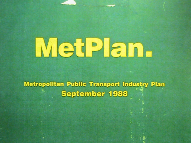
Like September 1988's MetPlan. A fourteen year development plan for trains, trams and buses.


The Minister's introduction sets MetPlan's flavour. Growth and confidence were to replace decline and decay. A patronage target was set. Specific measures included rail network extensions, longer operating hours, direct premium-service bus routes, all-night service and a revised fare and ticketing system.  A list of projects out to 2002 was included.


What happened? Within two years Australia had entered its most prolonged recession since the 1930s. Its effects were uneven with Victoria hardest hit. Manufacturing closed, local banks collapsed, unemployment surged and state government revenues plunged.

A desperate state government looked everywhere for cuts. Easily defeated 'scratch tickets' made fare paying optional.  Strikes over staffing and automated ticketing made trains and trams unreliable, driving passengers away. And newly slashed bus timetables made services unsuitable for commuters and weekend travellers alike. Being 'Transport Minister' was Victoria's political booby prize and none lasted very long.

Decline and decay were back. The infant MetPlan was shelved with little achieved by its 2002 horizon.  More enduring were the 1990s bus service cuts, with concerted action to reverse them only starting in 2006. And nearly thirty years later, there remain main road routes waiting to have service restored despite population and traffic growth since.

Double the time horizon and MetPlan looks much better. Many recommended rail extensions, extended bus operating hours, cross-suburban premium bus routes, all-night service and improved disabled access eventually happened. Discernible shortcomings include underestimating the benefits of service frequency on main routes and overselling prospects for demand responsive services.

What should one conclude? Despite its comprehensiveness, MetPlan was not influential beyond its first year or two. Afterwards wider economic and government budgetary issues overtook it and retained primacy for at least the following ten years.

What about the fate of more recent plans? There was a lot of talk around the time of the early 2000s Melbourne 2030 Strategy Its associated Linking Melbourne: Metropolitan Transport Plan defined a Principal Public Transport Network (PPTN). Despite its advocacy of higher densities around PPTN-linked transit-oriented activity centres and an ambitious mode-share target, service levels were rarely upgraded to make this credible. Instead issues around ticketing and rail franchising consumed much of  the government's energy around public transport.

Meeting Our Transport Challenges (MOTC) in 2006 had more success. While its third track to Dandenong was never built its bus service agenda was the most complete and ambitious ever publicly proposed. This was matched by action in its first three or four years with huge numbers of bus routes upgraded to minimum service standards and an extensive SmartBus network across (mostly) eastern and northern suburbs. In response bus patronage surged to its highest point in 40 years.

On the debit side, promised local area bus service review were done but implemention was patchy. This was not helped by some network recommendations being expensive with overlapping routes. Within four years MOTC itself had run out of puff. The roll-out of minimum service standards upgrades had slowed and a fourth promised orbital SmartBus was abandoned. Instead, with surging population, full trains and falling reliability, emphasis switched to rail infrastructure through the ambitious Victorian Transport Plan launched in 2008. Major initiatives in it, such as several new stations, the Regional Rail Link and Melbourne Metro Tunnel, are either complete or under construction. And new timetables, with simplified stopping patterns and higher frequencies, now operate on some train lines. 
  

More recently we have seen the 2013 Network Development Plan - Metropolitan Rail . This was based on removing capacity constraints on the network, simplifying operations and quickly upgrading all-day service frequencies to 'turn up and go' levels on the core parts of as many lines that infrastructure allows. Progress was initially fast with 'greenfields' timetables on the Frankston, Dandenong, Werribee and Williamstown lines.

Timetable reform has slowed since 2014, with emphasis switching to infrastructure upgrades and grade separations.  Nevertheless it is essential if we are to have a high capacity metro rail system and avoid repeats of the 2006-2010 commuter crushes. This plan might end up like MetPlan whose recommendations mostly got implemented but over a longer time horizon.

The above examples were presented to show that notwithstanding their quality, plans do not always have as much influence as their authors may like. Attention may shift. Momentum can be lost. This can be due to apparently urgent but peripheral issues like ticketing or franchising diverting administrators minds. Or whole of government budgetary pressures. In such an environment all departments may be required to cough up fast savings and cancel or defer plans.      

This is particularly important for public transport services. It (like roads and parking) attracts substantial public subsidy. Here in Melbourne it recovers about a third of its costs from fares. The state government kicks in the rest. Thus the health of its finances is critical to the ability to retain and improve services. 


Strong economic activity, high workforce participation and a booming property market have assisted state finances. The last election campaign, where both major parties promised lavish transport infrastructure, may have marked a peak in what was thought practical.

If state revenue rises slower than estimated, recurrent expenditure such as needed to run services is  vulnerable. That's because it's easier to cut than long-term capital commitments for which contracts have been signed. And cutting trips on a hundred bus routes tends to be less visible than (say) cancelling a high-profile road or rail project. 

Currently service is growing but at a slower rate than population. Thus service per capita is declining. Not increasing (and especially) reducing service will speed the per capita decline in service. That means that an increasing number of outer suburbs will go without service for longer. Elsewhere, crowding on popular routes will increase until people give up. Then more will take to the roads in their own vehicles, increasing congestion and further slowing buses and trams. This creates a vicious spiral of declining patronage and service.

So far we have assumed that all public transport service hours are of equal merit.

They're not. Some hours go towards well used routes with unique catchments. Others go to less busy routes that have a social rationale due to their geographic coverage and catchment demographics. Reducing service on these, such as occurred during the indiscriminate early 1990s cuts, would weaken rather than strengthen the network.

Then there are bus routes that closely parallel or even duplicate other services. This can happen when new routes are layered on top of old ones without a network review having been done.  That's happened a lot, as you'll see later. Or, a route may be too frequent for its present patronage due to demographic changes.

These services are harder to justify. They can make the network more complex. And they can pose an opportunity cost, sapping resources from potential upgrades such as network simplification, coverage extensions, longer operating hours or higher frequency on more deserving routes. And, if budgets are tightened, pruning or consolidating inefficient services may allow for more benign cuts that affect fewer passengers than the blunt meat-axe approach taken in the 1990s. 

The maps below are selected parts of the Melbourne suburban network. They are included because services in the area may be complex, duplicate one another or feature excessive frequency for their catchment. Comments on the routes involved appear below each map.

Millers Rd, Altona North


This is a major north-south corridor served by numerous bus routes. These include Routes 411 (1.5 buses per hour) and 903 (4 buses per hour). North of the railway also has 232 (3 buses per hour) while south of the railway has 412 (1.5 buses per hour). These overlapping services give the corridor between 6 and 7.5 buses per hour. However this does not translate to a turn-up-and-go 8 or 10 minute frequency as these services are run on different routes.  Weekend service frequency is about half that of weekday frequency.

Routes 411 and 412 are strong patronage performers despite their indifferent service frequency. Apart from where they split in Altona North they provide a simple and mostly main road route between Laverton and Footscray via Altona. 232, which runs into the Melbourne CBD via the West Gate Bridge is weaker. Also weaker is Route 903 between Altona and Sunshine. This is a SmartBus featuring extended operating hours. However its service frequency does not harmonise with trains in the area and its catchment is either industrial land or duplicative of other routes.

Altona North is remote from rail. Its demographics justify a good to excellent bus service. There are many schools in the area. However the number of buses per hour along Millers Rd may be excessive without the benefits of a regular frequency that would apply if only one main route operated.  A frequency of 10 minutes on weekdays and 20 minutes for weekends and evenings (until midnight) along the Route 411 alignment between Footscray and at least Altona would provide a simpler and more even service than now. Even if only a 20 minute frequency operated west of Altona, there would still be large gains for Altona Meadows, particularly on evenings and weekends.  Trade-offs would likely include (i) terminating Route 903 at Altona Gate or, more economically, Sunshine, (ii) Shortening or deleting the poorly performing Route 232 and (iii) an interchange at Altona Gate for those travelling from Altona to Sunshine. Also there wider are network implications, affecting routes like 412, 432 and 471.

Summary: Likely opportunities for improvement with network simplification and increased frequencies within existing resources. A local area review is desirable due to the network's complexity.  

Brighton area


The Brighton area has very high average incomes. Car ownership is high and its demographics are unfavourable for high off-peak public transport usage. High bus service levels reflect the old government Met days with many services running until midnight and missing the worst of the 1990s cuts (which heavily affected private operators). Later changes, such as the c2000 splitting of 600 into 600, 922 and 923, increased network complexity.

The area has a huge number of north-south bus routes. These include 600, 922, 923 in one group, 216 and 219 in another group and 220 as a stand-alone service. Service frequencies and operating hours vary widely but can extend to late at night.  Parallel bus routes run quite close to one another in parts of North Brighton. There is also some coverage overlap with the north-south Sandringham rail line, which except for Sunday mornings, offers a service every 20 minutes or better until midnight.  This is better than any other line where night service drops to 30 minutes.  In contrast, in directions where there is no rail from Brighton, for instance to the east, bus services are less, with (typically) hourly frequencies on each of the 811, 812 and 823.

Summary: Likely overservicing amongst north-south routes near the rail line. East-west routes to non-rail areas may justify better service. Network simplification and savings may be possible under a proper review process. 

Elwood area


Like Brighton, Elwood also has complex bus services. These include the 246, the 606 and the 600/922/923 family.  Route 246 is a busy, frequent direct route you'd likely leave alone. However it may be possible to simplify service by upgrading Route 606's hours and frequencies and deleting the very complex and overlapping 600/922/923 in the area. Elwood has more favourable demographics than Brighton (including many rental units) so should be able to support reasonable bus services.

Summary: Likely opportunities for improvement with network simplification and increased frequencies within existing resources.  

Plenty Rd through Bundoora


Route 86 tram is the centrepiece of public transport in this area. It runs at high frequencies for long hours seven days per week.  Overlapping much of it is bus route 382. It provides a one-seat ride to Northland Shopping Centre from areas further north. However as the area develops and local shopping opportunities spring up, the need for such a long overlap may lessen.

Also visible in the north-east quarter of the map is overlap between bus route 566 and 902. Both routes run east to Greensborough (off the map). Neither run to a frequency that harmonises with trains at Greensborough. The 566 has been long established while more recently Route 902 was extended over the top of it as part of the Green Orbital SmartBus. 566 is also incredibly confusing

The patronage potential of the area is only likely to support one east-west route (probably along the SmartBus alignment) but it is desirable that it harmonise with trains. The consequence of dropping to one route will however mean more interchanging for people making medium distance trips that can currently be done on the one bus.


Summary: Likely opportunities for improvement with network simplification and increased frequencies within existing resources. A comprehensive network review is required as travel needs are complex with multiple major trip generators.  

Thompsons Rd, Carrum


No one lives on this part of Thomsons Rd east of the Peninsula Freeway. Much of the land (shown in green) is for sewage treatment. But two overlapping bus routes run along there to Carrum Station. These include the long-established but infrequent 857 and the recently extended 833. 
The 833 was extended to connect Carrum Downs residents to Carrum Station so they didn't have to backtrack to Frankston. However nothing was done with the 857. There may be scope to remove duplication by sending the 857 a different way. There may be some benefit if this was done as part of a Mordialloc - Carrum area local bus service review. However there is unlikely to be significant cost savings since it will be necessary to use some other route to properly serve Patterson Lakes. 
Summary: Likely overservicing along an unpopulated section but requires network review to resolve. 
Coburg


This is an area where there are many closely-spaced or overlapping routes. Not all harmonise with trains (every 20 minutes). Like the Millers Rd (Altona North) example, routes have tended to be layered on top of one another without any being modified.  Examples include the 903 SmartBus orbital, 534 extension and most recently 561’s extension to Pascoe Vale.

It may be harder to simplify the network here than at Altona North. And even if services were simplified such that Bell St had an even ten minute frequency, the full benefits of this would not be obtained until Upfield line trains were upgraded to every 10 minutes at least as far north as Coburg.

An ideal network would likely have simpler routes. For example swapping 561 and 534 would provide a single flat 20 minute service along Gaffney St connecting directly to stations at either end.  There may also be possibilities if simplification reduces the number of routes by one especially if savings could be put towards increased peak frequencies, better weekend services and longer operating hours.  Overall, while there is scope for network simplification, population densification and gentrification (with more working in the CBD and amenable to using feeder buses) means that the area is likely not over-serviced. 

Summary: Likely opportunities for improvement with network simplification and increased frequencies within existing resources.  

Eltham/Diamond Creek


These are outer suburban areas with higher than average incomes, lower than average residential densities and relatively high car ownership rates.  Like other areas new routes have been added without review and reform of existing routes.

Bus routes in this area (eg 517, 580, 902) often operate at frequencies incompatible with  trains and thus be poor at connecting to them. For instance every 15 or 30 minutes versus every 20 or 40 minutes for trains.  This is true even for relatively recently introduced routes such as the 901 and 902 SmartBuses. Routes may duplicate trains (eg 343) or overlap other buses (eg 293, 901, 902 and 517, 518). Service levels on some routes are high for the low density catchment served (eg the 20 minute 7-day frequencies on Route 582 or the two buses per hour provided on 578/579 through a sparsely settled area).  

There are also routes that due to their length offer the same service frequency even though passenger catchments vary. For example Route 517 runs every 24 minutes from Northland Shopping Centre via Bellfield/West Heidelberg to Greensborough and St Helena.  The western portion justifies a good service frequency, with 20 minutes suitable for harmonisation with trains. This may be excessive during the day for the Greensborough – St Helena portion which may only justify a 40 minute service, which would nevertheless connect more regularly with trains than the existing service. 

Summary: Likely opportunities exist for simpler routes, better connections with trains and cost savings by removing excessive service.  

Emerald


The area east of Belgrave out to Emerald and Gembrook is semi-rural. Car ownership and use is high. Several bus routes operate to Emerald. The most notable is Route 695. This has a 30 minute interpeak weekday frequency. Given the large number of suburban areas that only have 40 to 60 minute frequencies and demographics more favourable for bus use, the 30 minute frequency provided on Route 695 may appear excessive if patronage is not high.  A thing to bear in mind is that the low 30 minute train frequency at Belgrave makes only 30 or 60 minute frequencies possible for consistent train connections. Whereas an upgrade to 20 minutes would give a choice of 40 or 60 minute frequency for the 695 while still connecting evenly with trains.

Network complexity is also an issue in the area. There is a Route 695F that only operates on some days of the week to Fountain Gate Shopping Centre. Another variant operates weekly to Dandenong Market. A review of these would seem desirable with a view to providing a 7 day service to major centres, with the possibility of connections if a direct service is not justified.

Summary: Given the area’s peri-urban catchment opportunities may exist for simpler routes and even minor cost savings.  

Buckley St, Essendon


This corridor has Essendon Station at one end and Milleara Shopping Centre at the other. There are also several schools nearby.  Route 465 was the original route. It survived the 1990s service cuts and retains a high frequency during the commuter peaks.  The 20 minute daytime Monday to Saturday frequency matches the train. Sunday service is every 40 minutes, meeting every second train.  Route 465 is a successful feeder for commuters to get to Essendon Station.

Like in so many other places, the SmartBus orbital 903 overlaps a large section of the 465. Its 15 minute weekday and 30 minute weekend frequency does not harmonise with trains.  There are no very large trip generators along Buckley Street that justify a SmartBus plus a strong direct local route. In contrast nearby Highpoint Shopping Centre has no SmartBus and only limited Monday to Saturday bus access from Essendon.

A network review would likely question the duplication of two routes along Buckley Street. A more efficient arrangement would likely involve diverting the SmartBus to where it was more needed. Eg it could run to Sunshine via Highpoint and Braybrook, with local network changes to avoid duplication.  Upgrading Route 465’s Sunday service to 20 minutes, extending evening operating hours to midnight, and, if needed, additional peak trips, should simplify travel for those on Buckley Street and compensate for 903’s removal.

Summary: Strong scope exists for network simplification in the area with duplication removed and remaining routes upgraded. Prospects for cost savings are limited but high patronage areas such as around Maribyrnong and Braybrook would gain SmartBus service if 903 was diverted. 
Warrandyte


Warrandyte shares many characteristics with Eltham. It’s a high income and high car ownership area. Population density is less than regular suburban levels. Yet both have SmartBus routes that provide better frequency and operating hours than other suburbs, with a greater need for good bus services, receive. For its location and demographics there are also relatively frequent (two buses per hour) bus services from Eltham (578/579) and Ringwood (364). There is also some overlap of bus routes.

Summary: Opportunities may exist for cost savings by removing what appears to be excessive service.  
Footscray/Sunshine/Highpoint


This area has the history, density and demographics that make its buses amongst the busiest in Melbourne.  With population density increasing, this will remain for the foreseeable future. Therefore you would never seek to reduce service levels. But you might simplify routes if it allows 7-day turn up and go frequencies to be operated on main corridors while retaining coverage.

While all routes are now run by private operators, this was not always the case.  The 200-numbered routes (215, 216/219, 220, 223) are ex-Met. Before that they were run by the Tramways board. Their (mostly) long operating hours and superior frequencies remain a legacy of when sections of these routes operated as the Footscray tram network (closed in 1962).  Routes run by private operators (eg 406, 408, 410) tend to be less frequent and operate over shorter hours.  About ten years ago they gained evening and Sunday service. However Sunday service frequency (every 40 or 60 minutes) remains much less than Monday to Saturday service.

Two main series of routes operate. Footscray to Sunshine (216, 219, 220, 410) and Footscray to Highpoint (Tram 82, 223 and 406). There is also 215 and 408 which extend west from Highpoint to the Sunshine area. All but the 410 extend outside this area. Key trip generators away from the stations include Footscray Hospital and Victoria University campuses in Footscray and Sunshine.

The east-west routes (216/219, 220 and 410 operate to a base 15 minute weekday frequency. A simple renumbering exercise would simplify these four numbers to three. However more serious change, such as going from three routes to two (and increasing each to every 10 minutes Monday to Sunday) would leave one east-west street in West Footscray without service. 

From the map it would seem obvious that the one nearest the train line (and currently served by the 220) would be the best candidate.  However existing strong patronage could tell otherwise. Because while some areas are near train stations, pedestrian access to stations like Tottenham is unattractive and train frequencies (every 20 minutes) are inferior to local buses, at least on weekdays. Therefore, while it might look like duplication on the map there is likely still a call for parallel bus services. 

Due to people changing to trains at Footscray (despite currently haphazard interchange arrangements) patronage on many of these routes seems to peak between Sunshine and Footscray rather than between Footscray and the CBD. This has implications for network design, noting though that, there not being a tram, Route 220 provides the only direct connection between Footscray and a part of Docklands.
Another question, also affecting Route 220 is whether it and 410 should overlap along Ballarat Rd or whether a single route (operating all along Ballarat Rd at 5 to 10 minute frequencies 7 days per week) would be more legible.

North south issues relate to the need to provide easy connections from Footscray Station to VU and Highpoint.  Routes 82, 223 and 406 pass near both. Along with 472 near VU. The combined frequency is very high. However legibility is poor with stopping locations dispersed. This means that if you have just missed a service on one route you will not necessarily wait for another route. And with their base 15 to 20 minute frequencies, waiting times for each route can be a  the high proportion of travel time.  A likely bus-only consolidation may involve some form of amalgamation between routes 223 and 406 to provide a consistent 10 minute or better 7 day service between Footscray, VU and Highpoint. Every second trip could extend beyond Highpoint so that the current 406’s frequency is retained, with the possibility of a weekend service boost.

Summary: Scope exists for network simplification in the area to overcome existing complexity. This will require a comprehensive review given the existing network's high usage. Existing high patronage and increasing density warrants high 7-day frequency and long operating hours on most routes. 
Knox


Along with the Mornington Peninsula, bus services in much of Knox has been neglected by successive governments. While developed in the 1960s and now at suburban densities, only rudimentary service runs away from a few main roads. Local routes can be indirect, due largely but not entirely to local street layouts.  Plus there can be overlap with demand-responsive Telebus routes that operate in the area.

Overlaps include those of the infrequent 681/682 paralleling the newer 901 along Stud Rd to Knox City (although the less frequent 665 ran before that).  Another is 691’s overlap of the 900 to the west. The 691 is the original route in the area dating from when Waverley Gardens was an important destination before local retail offerings such as Stud Park developed and Knox City expanded.  While not shown fully on the map, there are significant overlaps between the 693 and 753, and further west, between 693 and 742. Their presence may lessen the case to upgrade services on the very direct route 693.  And to the north (barely shown) is a section of overlap between the long-established 664 and the newer 901 orbital.

Summary: While overlaps and duplications exist, service in Knox is so sparse that even if they were removed additional resources would likely be required to provide even a ‘minimum standards’ style service to most residential areas.  
Campbellfield and Camp Rd


The residential part of Campbellfield is another example where bus services have hardly changed for decades. Despite being somewhat isolated and low-income neither of its two routes (531 and 538) received minimum standards upgrades. Consequently operating days and hours are limited including no Sunday service.

The later replacement of the previous route 560 with the higher frequency 902 orbital along Camp Rd did not lead to a review of the 538 which overlaps the 902. This might have been due to the 538’s coverage of parts of Jacana away from the 902. If service here was to be preserved this would likely have required a route in Hadfield or Glenroy to be extended to Broadmeadows. 

Nevertheless Campbellfield’s hosting of two overlapping, infrequent and limited service routes is unsatisfactory. Removing 538 would have removed the direct connection to Broadmeadows. However it may be possible to find other arrangements involving joining 531 with some 540 trips or operating it to Broadmeadows via parts of Dallas somewhat away from a bus.

Summary: While overlaps and duplications exist, a reformed network would require a mini network review involving several routes.  Existing low service frequencies mean that cost savings are unlikely.  

Box Hill - Deakin Uni corridor


Box Hill to Deakin Uni is a strong bus corridor.  Four infrequent routes (201, 281, 767, 768) serve a roughly similar corridor, though stops at the campus end vary.  Unlike other universities, which have ‘turn up and go’ shuttles, none of Deakin’s routes by itself offers an attractive frequency and the network is less legible as a result.  I discussed this in great detail here.

Summary: Rationalisation, involving two or three routes, is required to provide a useful service between Box Hill and Deakin University.  Any economies realised should be reinvested to provide the most frequent possible service.   

Oakleigh/Huntingdale/Clayton 


East of Oakleigh are three corridors with overlapping routes heading east for a significant distance.  These include Princes Hwy (800, 802, 804, 862), Ferntree Gully Rd (693 & 742) and North Rd/Wellington Rd (601, 630, 900, 802, 804, 862).  Route 601 is an express university shuttle while 900 is a limited stops SmartBus. The others serve all stops.  

Many years ago 802, 804 and 862 were timed so they provided an even 15 minute weekday frequency. This has been broken down in recent times and intervals are now irregular.  There is further complexity as one of these routes (862) operates 7 days per week while the other operate 5 or 6 days per week.  No routing changes were made when the 900 or 601 were layered over the existing network.

The area has undergone significant population densification.  Much of this is driven by Monash University and its student population with a high propensity to use public transport. The planning response has been to add new routes rather than to review and strengthen existing routes with higher frequency and 7 day service. The result is the complex network you see above.


Summary: Network simplification, based on easier to understand routes operating at higher frequencies, is desirable. Any cost savings should be reinvested to improve services within the area. 

Springvale/Noble Park/Keysborough


This area has demographic similarities with Sunshine/Braybrook with low average incomes and demographics favourable for public transport usage.  Unlike Sunshine/Braybrook service levels are low in all areas away from a train station or Springvale Rd.  Buses may run hourly and not on Sundays, despite upgrades promised in 2006.  Anyone who objects to previous comments about bus overservicing in Brighton, Eltham and Warrandyte should be taken to this area to observe bus usage and concede their good fortune.

The basic structure of the bus network in this area has not changed for decades.  Main changes has been the frequency upgrade when routes 888/889 were converted to SmartBus and the roll-out of minimum standards to some routes.  The area has also gained from recent road/rail grade separations and the extension of Route 709 to serve more of Keysborough.

Summary: Network simplification, based on easier to understand routes operating at higher frequencies, is desirable. While network reform may free some resources, it is possible that (like in Knox) the historic pattern of underservicing requires resources from elsewhere to deliver the desirable 10 to 20 minute 7 day frequencies on major corridors. 
Other routes

Some other routes are known to carry few passengers. The areas served may not necessarily contain concentrations of people who depend on the service. Examples include Route 673 (little unique coverage), 687 (very low population density), 694 (only unique coverage is in a sparsely populated forest) and 696 (a low usage shopper service). These might be examined as part of area-wide reviews. 

Other factors when optimising or economising service

Above I looked at area maps to find overlapping routes. I concentrated on corridors where routes were not time staggered to form a combined frequency corridor. The assumption is that fewer but more frequent routes would be simpler for passengers to use and understand. In other cases I considered service frequency in sparsely populated or low patronage areas. High service where patronage is low may provide scope to economise on route kilometres without affecting many passengers. 

It's not just about maps and overlaps. Other factors also come into play when considering whether a network is efficient or not. A route may appear to be overserviced but operating it frequently might be very cheap if it plugs a hole in a roster or lessens layover or dead-running. In other cases while frequency might appear high it might allow economical use of a bus or harmonise with a train service. A lower frequency may prove a false economy that costs patronage. School student demand needs to be considered; some areas might have a concentration of routes that seem quiet but come alive during student travel times. Then there are special school services that form a large part of a bus company's business and affects rostering and timetabling for regular public routes.


The above may make network reform harder. But it's not a reason to avoid it. While it may be true that  inefficiencies due to route overlaps impose a cost that is a low proportion of that needed to run the entire network, they can still be high in particular areas.


Not tacking them lessens the affordability of network reform that in some examples above would improve service to passengers. And when budgets tighten, as they might due to reduced tax collection, then knowing where the inefficiencies and overservicing are can result in a smarter approach to pruning service with the least passenger impact, or in some cases even deliver benefits.  

Update

Just after this item appeared, I realised I wrote an item very similar in 2010. A couple in that list have been pruned as part of local bus network reforms. I'll revisit that item in a later post. 


You might enjoy these well-regarded books on transport topics

Better Buses, Better Cities: How to Plan, Run, and Win the Fight for Effective Transit Steven Higashide NEW!

The Public City: Essays in honour of Paul Mees Gleeson & Beza

A Political Economy of Access: Infrastructure, Networks, Cities, Institutions (Access Quintet Book 4) David Levinson

Human Transit: How Clearer Thinking about Public Transit Can Enrich Our Communities and Our Lives Jarrett Walker

Transport for Suburbia: Beyond the Automobile Age Paul Mees

(Sales links: I get a small commission if you buy via the above - no extra cost to you)