Showing posts with label passenger information. Show all posts

Friday, June 17, 2011

Passenger communication on a fragile network

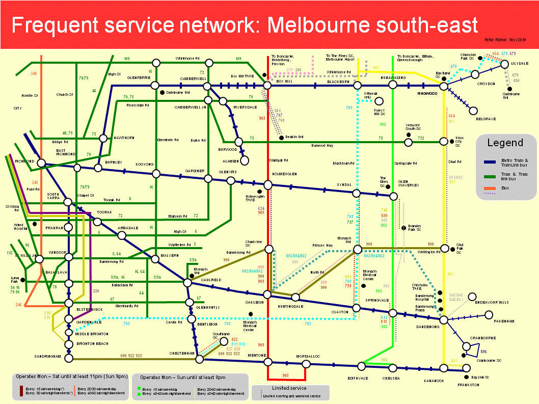
On a rail network prone to disruption due to track faults, signal failures, loss of power, train faults and level crossing accidents, communication with passengers is critical.

This morning's power failure between Frankston and Carrum stations (due to a truck running into a power pole) caused widespread service disruptions during the network's busiest period. It also sorely tested the capabilities of each communication system available.

Passengers at unattended stations (ie the majority) have the following facilities:

1.Automated PA announcements of next train

2.Manual PA announcements (from control station)

3.Green button

4.Red button (intended for emergencies)

5.SMS alerts (sent by train control)

The strengths and limitations of each will now be discussed

1.Automated PA announcements

These announcements are broadcast via horn speakers located on light poles along the platform. Volume varies and messages are sometimes inaudible at some points along the platform (even though it's desirable to spread passenges along it to speed boarding). This is especially the case during the morning peak at stations near busy highways where peak road traffic drowns out announcements. In contrast volume is well above ambient noise at night - even to the point where local residents complain. Of course these automated announcements presuppose trains are operating so are of limited usefulness when service is suspended (unless set to disruption mode at a control desk).

2.Manual PA announcements

Manual PA announcements can be the best means of communicating to passengers at remote unstaffed stations, especially when circumstances change at short notice. These use the same speakers as the automated announcements but are far more useful in the event of disruption. This effectiveness is enhanced because control desks are able to make these specific to a particular station or for a large section of line (most useful for large-scale disruptions as on Friday).

Like automated announcements, intelligibility may be low in noisy station environments (as was the case today). Different staff have different speaking voices and levels, further affecting clarity. Control desk staff are not studio technicians and have no access to level and tone adjustments – and even if they did there’s no staff at unstaffed stations to check. While not a panacea, audio compression may help as it reduces volume changes between different voices and thus improves readability.

Frequency of announcement is equally critical, especially during peak periods where hundreds of passengers per minute are entering stations along the line. Ideally these should be every two minutes. Operational circumstances vary and it is difficult to assure quality. However intervals of up to eight minutes between manual announcements are not acceptable, especially if not all are intelligible and other communication methods are not working.

3.Green button (or ‘PRIDE’)

This is the chief means of real-time information at stations without ‘next train’ visual displays. Passengers press the green button and hear next train announcements, including ‘minutes to’. This works most of the time, but, during disruptions the ‘minutes to’ announcement may be omitted. This is most important in helping passengers decide whether they should wait or seek other transport. The system may also sometimes ‘ring out’ and not provide any annoucement. This is understood to be most likely when too many passengers at too many stations are pressing the button at once (a particular risk at unstaffed stations that haven’t seen a train for a while).

4. Red button

This is intended for emergency use only and allows two-way contact with the nearest control station. However passengers sometimes press it, either accidentally, maliciously or to enquire about delayed or disrupted services when announcements have been infrequent or inaudible. Sometimes this reminds the control desk that another PA announcement is overdue and one is given soon after.

5. Text alerts

Mobile phone text alerts are the latest way of informing passengers of service disruptions. They originate from the CBD-based train control, ie a different source to local manual announcements. Passengers can customise required information to their line and travel times and information, if given sufficiently in advance, is provided before the passenger reaches the station. Alerts are often received after the time has passed for passengers to do anything about it - especially where trains are altered to bypass the City Loop or major disruptions cause high message volumes and slow sending. Increasingly important, as more get mobile internet, will be website alerts, again issued from Metrol.

Conclusion

Each information system has its strenghts and limitations. Performance, such as clarity, accuracy and timeliness, often suffers when it is most needed, ie during service disruptions. Substantial improvements in all methods are desirable but it would seem to me that the humble manual PA announcement made locally (or to a group of stations on a line) offers the greatest potential to be cheaply improved in both quality and quantity.

Sunday, May 22, 2011

Voices of the Railways: suburban train and station annoucements

Harold Clapp famously said that railways are "95 percent men and 5 percent iron".

One duty of those 95% is informing passengers of arriving trains, delays, changed platforms or altered running. Unlike some overseas subways where different lines operate independently and rarely share track, trains can and are swapped between different lines on Melbourne's more complex network. Platforms can change at short notice and late arrivals may form trains other than those specified in the working timetable. In addition point and signal failures commonly cause delays and City Loop bypasses.

It is often platform and control staff (at stations) or the driver (on trains) who first inform passengers of delays and alterations. At other times they make safety annoucements and inform passengers of connecting services.

The multiple skills required are not always obvious. They must understand the network, think on their feet and quickly process and translate what may be incomplete information from train control into advice useful for passengers. Their enunciation must be understood by passengers of all backgrounds through varying station acoustics and public address system quality. And announcing may be only one part of the job - other roles include signalling, selling tickets or driving trains.

The video presented is a compilation of train and station announcements, recorded on the 19th and 20th May, 2011. A few are automated but most are manual. As you'll hear automated annoucements are fine if all is running to plan, but when it is not manual annoucenements rise to the fore. And it is precisely these times that they are needed most.

Tuesday, May 10, 2011

First weekday of new train timetable

Some of the sights from around the network, filmed yesterday.

Tuesday, December 28, 2010

Postcard from Tasmania: No spirit for the Spirit

In keeping with the season’s holiday mood, following are two snapshots of transport outside Melbourne. The first discusses ferry passenger connectivity facilities at Devonport, as encountered last week.

There couldn’t be any more contrast between transport facilities at each of the ‘Spirit of Tasmania’ termini. The Spirit is a large car and passenger ferry with daily night sailings with day sailings added during peak season.

Melbourne’s Station Pier is at the end of a major tram route, running every few minutes mostly on its own right of way. Pedestrian access is short, direct and legible, with excellent walking and cycling paths. A convenience store and restaurants are within sight. While less prominent, Bay Street’s shops and services are also comfortably walkable.

Devonport is Tasmania’s third city, smaller than only Hobart and Launceston. It is Tasmania’s northern gateway, welcoming backpackers and tourists to surrounding mountains, trails and farms.

The city is divided by the River Mersey. The CBD, accommodation, entertainment, tourist bureau and most housing is on the west bank. On the east is light industry, some housing and the Spirit of Tasmania ferry terminal. The ferry terminal is a stone’s throw across the water from the city centre, with land access via a bridge approximately 2km to the south.


View Larger Map

The Spirit of Tasmania and the people it brings is important to Devonport’s life and economy. Childrens’ murals on the showground’s wall often depict the ferry. The council office names Devonport as the ‘City with Spirit’. And the ship’s daily horn, what is to Devonport as church bells are to a medieval city, removes any doubt.

If the ferry is such a big thing in this town, let’s see how well the transport needs of its passengers are looked after, especially those who came without cars.

The photo shows the first impression arriving passengers get after leaving the ferry and collecting luggage.

Following are seven observations made following the day sailing on December 22, ie close to peak season.

1. The Spirit of Tasmania is scheduled to arrive at the 'out of town' East Devonport terminus at 6pm. However the Torquay ferry, which could provide a quick trip into town, only runs from 8am to 6pm, unsuitable for Spirit passengers arriving after six. The local tourist bureau confirmed services are not extended an hour in peak season to cater for the day ferry’s arrival.

2. The Merseylink town bus service operates to East Devonport via the aforementioned bridge. Route 60's nearest stop is about a five minute walk east of the ferry terminus (see map) so is potentially useful. That is until one checks the timetable, which had the last weekday bus leaving at 5:46pm. On Saturdays the last bus is at 4:00pm, while no service runs on Sundays. Again this service finishes too early to be useful for ferry passengers. In addition few town bus stops inspected had timetables, maps or route information so these service only really cater for residents, who through trial and error, already know where the bus goes.

3. Despite the absence of conventional public transport (ferry or bus) there appeared to be no shuttle bus to take alighting passengers to central Devonport, which would be a key destination for those staying or touring locally.

4. No taxis were seen in the area, despite the likely brisk business, due in part to the above limited transport options. There also appeared to be no visible taxi rank or signage indicating same.

5. Some ferry passengers had bicycles – presumably for touring. There were no defined cycle routes or wayfinding signage to guide their 4km ride into town, although the Council's Cycling Network Strategy identifies their need.

6. The tourist bureau correctly advised that the ferry terminal is about an hour’s walk from Devonport CBD. Again there was no map or wayfinding signage at the ferry terminal to assist those walking into town. Hence the sighting of of lost backpackers in an industrial area’s intersection not far from the ferry terminal.

7. The locals know their town has lousy transport, and sometimes offer tourists seen walking a lift. Although haphazard, this appears to be the most effective transport option that Devonport can offer day sailing passengers.

Conclusion

Melbourne has more than 100 times Devonport’s population. The big-city facilities at Station Pier are neither expected nor appropriate at East Devonport.

Nevertheless Devonport’s failure to provide low-cost facilities such as street maps, pedestrian and cycle wayfinding signage and taxi ranks surely reflects poorly on its support for a ferry service that Australian taxpayers subsidise (cars, not passengers, mind you). Extending either the Torquay ferry or Route 60's hours so it meets all Spirit sailings would also help connectivity.

Until then Devonport is worth visiting only to learn what not to do when it comes to connecting various transport modes or looking after disembarking passengers. As discussed last year southern Tasmania offers riper pickings for the transport tourist.

Tuesday, November 16, 2010

Frequent service maps – now Melbourne wide

A pet personal project (obsession?) has been the compilation of schematic maps showing Melbourne’s frequent transport corridors, offering service every 15 minutes or better.

Melbourne’s inner suburbs have many such corridors thanks to its extensive tram network. Further out, fifteen minute weekday frequencies are available on some train lines and bus routes. Around half of our frequent bus corridors bear SmartBus branding, while the other half receive no special marketing.

While trams and trains are visible and legible, buses remain a mystery to the average traveller. Public transport is widely considered effective to get to the city but not so useful for cross-suburban trips, which dominate most people’s travel.

Simplifying the network through multi-modal frequent service maps is one way to make the network more legible and counter a major objection to buses; namely that they do not run frequently or late enough. The resultant network becomes more web or grid like, making it suitable for many more trips than the largely radial train and tram systems on their own.

I started with scribbles on taped scraps of paper. Plain shower curtains from discount shops were then tried. Windows Paint worked but smeared badly with each alteration. Finally Power Point was found workable.

Two maps for Melbourne’s eastern suburbs have previously appeared here. These have been updated and are presented with new maps for Melbourne’s north, west and inner, as below:

Melbourne west

Melbourne north

Melbourne north-east

Melbourne south-east

Melbourne inner

I will be the first to admit that these maps are not perfect.

Some maps, particularly the south-east, are way too cluttered. Deleting parallel lower service routes (so the key can be removed) and/or making each map cover a smaller area may help. The orientation of some streets (particularly the CBD) is not always ideal. And a few areas, such as around Port Melbourne and Prahran, fall within two maps but are well documented by neither.

Trying to reconcile geographic accuracy with simplicity was a challenge. So was illustrating both frequency and span. For the latter I made thickness represent frequency and line continuity represent span. Although it made the layout less clean, I wanted to show lower frequency routes that share the same corridor with high-service routes, and so boost combined frequency further.

Some of the complexity reflects the different service levels across the network. Bus routes especially don’t always fit neat categories such as (i) high service SmartBus, (ii) minimum standard local route or (iii) limited service special route. This shows that mapping can only simplify the network so much; planners need to do their bit to straighten routes and harmonise spans and frequencies as well.

In some cases I broke my own rules as the maps would have looked silly otherwise (eg half the rail network missing). For instance northern suburbs trains and western suburbs trains and trams operate every 20 minutes, and I have shown them even though the cut-off generally used was 15 minutes. If there was a rationale, it could be that people are willing to sacrifice frequency for trains’ average higher speed and comfort.

What these maps do demonstrate, however, is that frequency maps can provide a fresh way of seeing (and using) the public transport network that should be helpful for planners, providers and passengers alike.

Thursday, October 14, 2010

Connectivity mapping and the interisland ferry

To date Melbourne on Transit has not covered ferries. This is because, unlike Sydney, Brisbane or Perth, they are not an established part of city public transport. And while proposals for commuter ferries are sometimes made, all trials of them have been unsuccessful.

This may be because Melbourne has an extensive rail network that largely follows the populated coast, serving areas such as Williamstown, Brighton, Frankston and Geelong that might otherwise support a ferry service. In addition the narrow Yarra does not divide the city like the much wider Sydney harbour, so land modes dominate travel to every suburb, with ferries strictly for tourists.

Outside Melbourne

However outside Melbourne there are two ferries that provide a service more direct than is possible by road. These are Portsea to Queenscliffe across the mouth of Port Phillip and the Interisland Ferry between Stony Point, French Island and Phillip Island. The operators of both these services are granted an exclusive licence to serve these routes by the Department of Transport.

The Interisland ferry serves three locations; the mainland outpost of Stony Point, the uninhabited nature reserve of French Island and the tourist and motor racing hub of Phillip Island.

The timetables are presented in tabular form on the Interisland website, with tables for each island. Only departure and travel times are shown, so arrivals must be estimated. Trips mostly operate beween Stony Point and Phillip Island via French Island, but sometimes the order is different, or services only serve two locations.

Transport operators normally provide a tabular timetable and separate map to help passengers plan their trips. This suits the whole range of service levels; from a weekly bus to an intensely served tram line.

However if only a few trips run per day and route variations exist, as is often true for country services, it’s sometimes more informative to combine the map and timetable on the one sheet. Each trip would have its own line between locations, like a train graph. And instead of being on a table the arrival and departure times would be written near the end of each line.

As well as being good for spacial thinkers, a graphical timetable tells much more about how the service works. The user can follow each vehicle around its run and identify relationships between trips, such as what forms what or how many vehicles are used, that are not disclosed on a table.

Below is a timetable-map made from departure lists on the Interisland ferry website.

I have arbitrarily seperated trips into six runs (not all daily) operating from Stony Point. These show how one ferry can run a variety of trips around the islands from morning until night.

The most common trip is between Stony Point and Phillip Island via French Island. However there is also a direct Stony Point – French Island return service and a trip from Stony Point direct to Phillip Island and then French Island.

Other transport

The only other public transport serving Stony Point is the train to Frankston. This is a country-style diesel service that connects with electric trains to Melbourne. Both the train and ferry have uneven intervals between trips; in the train’s case due to a single track, and for the ferry because the operating pattern includes several trip variations.

The ferry runs a basic 7-day timetable, with extra or deleted services depending on the day of the week. In contrast, like most land transport routes, the train has different times for weekdays, Saturdays and Sundays.

As well as the ferry, Phillip Island (whose east is joined to the mainland by road) has a coach service operating to several locations including Melbourne CBD. Although longer as the crow flies, this involves fewer changes than the two trains and ferry route via Frankston and Stony Point.

Showing connectivity

A full multimodal timetable-map for the area would have at least three versions – one for each day pattern. This would show connectivity in a more graphical form and make analysis of it easier. Each train and ferry trip could be shown graphically, with waiting times given for each connection.

The map above takes some short-cuts including showing all days on the one map and listing rather than drawing train arrivals and departures. Connectivity from Melbourne CBD is also not shown; potentially an issue on Sunday mornings where the service that feeds the first train to Stony Point is not a Metro train but a NightRider Bus.

Nevertheless having all times on the one sheet allows easier comparisons of connections. And by being able to see where a train or ferry is at a particular time, including dwell times, a graphical format should make it possible to check if any proposed time changes would increase or lessen connectivity.

Limitations

Even the best timetable presentation method may not necessarily correspond with how services are actually run. An example is the habit of some schedulers to round travel times down in the early part of the trip but add the minutes back between the second last and last timepoints. The benefit here is that though the service may appear a couple of minutes late when passing some timepoints, it arrives at the destination on time. This may lessen early running and waiting at timepoints. Early running, in particular, is objectionable, and performance standards treat it more harshly than minor late running.

In the case of the ferry, the first Sunday train arriving at Stony Point (arriving 8:01am) would appear to just miss the ferry (timetabled departure 8:00am). However my understanding (gathered when researching this piece) is that although pasengers are asked to be at Stony Point well before the departure time, in practice the ferry will wait for the train, making an apparently impossible connection work.

Monday, September 27, 2010

Three new routes

Like yesterday, today was a significant day for Melbourne buses, with three new routes commencing in Melbourne's south-eastern suburbs.

625 and 626

The first two, 625 and 626, are the successors to Route 627. This was considered by some to have been Melbourne's most confusing bus route. Passengers often boarded the wrong bus, and the travel time between the termini of this bent hairpin route was slower than walking speed.

Route 627 also operated to the pre-2006 standard for Melbourne buses, ie no service after 6 or 7 pm or on Sundays. In contrast the new routes feature improved directness, an extension to the Sandringham railway line (626) and longer operating hours including Sunday and public holiday service.

Stop at McKinnon Station

Passenger advice - 627 is no more

Brighton terminus

2 - 4 buses/hour apparently contributes more congestion than residents' SUVs

626 at Chadstone

Route 625 approaching Chadstone Shopping Centre

709

709 is an entirely new route. It serves the suburb of Waterways. This is an exclusive 'green wedge' housing development remote from existing suburbia. It has no schools or shops but residents are said to value the area's cleanliness and serenity.

While the eastern part of the suburb was walkable to SmartBus Route 902, the majority of areas were over ten minutes walk from any public transport. Route 709 provides a basic service to Waterways and Epsom estate from Mordialloc Station, operating approximately hourly until 9pm.

Sign at Mordialloc indicating the new route

Gateway to Waterways

Waterways terminus

Sunday, September 26, 2010

The Yellow Orbital's first day

The first trip

Today I was part of a small group who rode the maiden full-length journey of Route 901 Yellow Orbital SmartBus. We took NightRider and Skybus to reach the airport by 0600.

Our aim to catch the first bus at 0630 nearly didn't happen since the bus did not pass the location indicated as its stop by a temporary sign. Luckily one of our group had the foresight to wait elsewhere and could hail the driver who stopped around the corner so the rest could board. This appeared to be an early glitch; subsequent trips were observed by others to use the marked stop.

Not suprisingly we had the bus to ourselves for the first hour or so; it was still too early for most Sunday engagements and many facilities along the way were under construction. Patronage increased greatly on the established Ringwood to Frankston portion, with the section south of Dandenong carrying a fully seated load nearly to Frankston.

The driver paced his speed well and the bus ran to time for the entire route. There was a short recovery time at most timepoints, but this should lessen once patronage builds and extra time due to ticket sales is factored in (travel is free for the first two weeks).

Along the route

Scenery varied between light industrial (most of the route until Epping and around Dandenong), bulky goods retail (around Nunawading) to residential (around Gladstone Park, Epping, Templestowe, Knox and Frankston North). There were also forested and semi-rural pockets around Yan Yean, which by any standard now has an extremely generous bus service for its population density.

Patronage potential

The existing Ringwood - Dandenong - Frankston section of Route 901 is now established as a high patronage section. It's everything a successful bus route should be - a direct line between trip generators of regional and even metropolitan significance.

Though its environment is pedestrian hostile, the sheer size of retail trade (and workforce) along Nunawading's 'Golden mile' along Whitehorse Road should assure reasonable patronage along this section as well.

My guess is that the north-eastern portion of the route won't be so popular; its feeder role to Blackburn Station will be somewhat lessened by the DART routes which will soon offer SmartBus-standard freeway express city services to much of Manningham. It also passes through areas of suburban (but low) population density at Templestowe and rural levels of density around Yan Yean.

South Morang to Epping should be moderately used as a rail feeder, though this task will be performed by Route 571 which will operate until suburban rail reaches South Morang.

There is some industrial jobs between Epping and Roxburgh Park (especially after the Market opens) that should attract some patronage. It is also from Epping (or even Greensborough) that 901 becomes a faster service to the airport than catching a train to the city plus a Skybus.

Route 901 duplicates local routes between Roxburgh Park and Broadmeadows and Route 902 between Broadmeadows and Gladstone Park. Hence in under a year Gladstone Park has gone from having very low to high levels of transit service.

I would expect the airport portion to be extremely successful - provided that the stop is in a handy location (for both travellers and airport workers) and people know about the service. The airport precinct is a huge employment area and the route will be a big lift for the area, which until today had extremely low service levels.

Photos taken on the first trip

Promotional billboard on entrance to the airport

The old stop for the regular routes (478/479/500)

The new (temporary) bus stop sign

Broadmeadows

Roxburgh Park

Greensborough

The Pines Shopping Centre (Doncaster East)

Finishing touches at Blackburn

Arriving Frankston

Timetable at Frankston

One passenger who won't be needing a service to the airport

Departing Frankston for Melbourne Airport

A new voice for Metro Trains

The changes are not simply a new voice; there are content alterations as well. 'Trains' are no longer 'trains' but 'services'. The reminder about ticketing has been extended to include Myki.

Voice timbre varies, with the male voice deep and resonant while the female voice is slightly thin and nasally. Enunication is also different and in this listener's mind the timing is less measured. For example the new speaker draws out the 'a' in Frankston but clips (or has clipped) the leading zeroes in departure times.

Tuesday, September 14, 2010

Should train network maps show buses?

Since franchising, on-vehicle public transport information has been mode (and for a while) operator-specific. The old Met-era multimodal inner-city transport maps on trams are now just a distant memory.

Passenger wishing to make connections have to be prepared beforehand, especially if alighting at an unstaffed station. There is often now wayfinding signage at station exits, but rarely bus timetables or current pedestrian-scale maps.

Having to cross a busy road only to find out that the next bus is 30 minutes away discourages interchange and spontaneous bus patronage. Whereas a bus timetable at the station exit would be visible to alighting passengers and encourages bus usage, even if it's only on days where the bus is only a few minutes away. It's also better for families as there's fewer phone calls home and fewer requests for lifts from the station.

Such details are especially important in cities where train arrivals are unpredictable and buses are infrequent; statistics demonstrate that the train-bus transfer rates for transit systems with mode-based planning such as Melbourne's is much lower than for a master-planned network like Perth’s.

One way to encourage passengers to think of the system as a versatile network (suitable for many trips) rather than a collection of routes (each capable of only a few) is to introduce multimodal elements onto mode-specific maps.

Melbourne has started doing this by indicating points where other modes can be caught with a small square, circle or triangle. However these do not indicate where the intersecting service goes, its route number, frequency, nor even if it is running on the day of travel.

Further advances could be to show intersecting routes, ending up with either a comprehensive local area map or schematic frequent service map. While such maps are useful they can introduce clutter for train or tram-only passengers, especially if applied at the metropolitan-wide scale. Possibly the best compromise are several maps at interchanges for different purposes. Examples could include a schematic metropolitan-wide railway map, a schematic frequent service map (covering about a 10-15km radius), a local pedestrian and bus map and an interchange map for large stations.

There could also be scope to introduce further multimode features on conventional single-network maps. An example is presented below.

This is the familiar Metlink/Metro Melbourne train network map with the three orbital SmartBus routes linking outer suburban stations (effective later this month). Its purpose is to convey a more versatile web-like network suitable for trips other than CBD-direction travel, especially for middle and outer suburban residents.

Detail has been kept low to avoid clutter (the main problem with adding buses). Only the orbital SmartBus routes that link most lines have been included. Hence it could reasonably replace the train-only network map (saving costs and space) without overwhelming the passenger. Additional details of local routes could be given through frequent service maps at the regional level and all-route maps for those making shorter trips. Such more specific maps are more suited to stations and interchanges than on trains, which may travel over much of the network.

Friday, September 10, 2010

Frequent Service Map 2: Melbourne’s north-east

A few posts ago I posted a frequent service map for Melbourne’s south-eastern suburbs to show the area’s high-service train, tram and bus corridors.

You might choose to live along these corridors if you value the choice of not having to drive everywhere. Businesses can establish in these areas and have quality public transport for their employees and customers in at least some directions. Or, if a tourist, you can travel to these locations with the confidence that service will still be running when you want to get home and that you won’t be waiting an hour if a service was missed.

Today’s map covers the north-eastern suburbs – roughly the City of Manningham with a bit either side. It was done in time for the introduction of five SmartBus routes to the area (mostly as part of Doncaster Area Rapid Transit) within the next month.

The map below shows Manningham’s frequent service network from October 4, 2010. The main routes form a grid of roughly 1 to 3 kilometre intervals. These put most of Manningham within 20 minutes walk of at least one SmartBus service. Service levels include a 15 minute weekday frequency until 9pm. At other times buses operate every 30 minutes until midnight, except Sundays where a 9pm finish applies (do people near trains and trams have later bedtimes?).

Click here for higher resolution pdf (recommended for printing or study)

As with the earlier map, continuous lines indicate long service spans and thick lines indicate the highest service frequencies. Low-frequency and peak-only routes are omitted except where they overlap much of a higher service route and boost frequencies along a corridor.

Sunday, September 05, 2010

An updated 'Zen'

For a complex asset that cost so much to build, the information presented to passengers on the use of the City Loop is decidedly sketchy. As suggested here before, this may be because the City Loop is only regarded as a CBD distributor for suburban passengers (its original purpose) rather than also forming a transit system in its own right for inner-city trips.

The Metlink journey planner has revolutionised trip planning, but there remains no officially-produced printed or web publication telling people how the loop works. The only known exceptions are pamphlets issued to passengers on a particular line when alterations occur as part of a new timetable. Instead one needs to plough through timetables for each line to build a picture of how it works, something most passengers are unlikely to do.

For many years this gap was filled by the Zen and the City Loop website. It's existed for about as long as Melbourne public transport has been on the web and has legendary status amongst transport geeks.

Unfortunately, though still mostly correct, 'Zen' is showing its age, with content not reflecting changes in the last year or two.

For another purpose I started producing some Loop diagrams. Something about the Zen diagrams must have stuck in my mind since there is a signficant resemblance, despite not having looked at them for a year or more. Anyway for posterity these diagrams, based on the June 2010 timetable, are presented below.

Note that these diagrams reflect the June 2010 timetable and will change again after the 10 October 2010 timetable takes effect.

Friday, August 20, 2010

Frequent service Map 1: Melbourne's south-east

Via Jarrett Walker is advice that Vancouver’s TransLink is seeking ideas from the public for a frequent network map, to highlight high service routes and corridors.

We have never had such a map for the Melboune network. More than any other Australian city frequency here has been a function of mode. Trams are most frequent, offering ‘turn up and go’ service every 5 to 15 minutes, at least during the day. Trains are next, on 15 to 30 minute frequencies. Buses were last, typically operating every 20 to 60 minutes, with varying spans and operating days.

Although there were exceptions, if you wanted frequent travel and an assurance of being able to travel on Sunday or get home at night you would almost never catch a bus. Hence train and tram system maps (normally mode rather than area-based) were our de-facto frequent network maps.

In the last five years we have seen the extension of many bus services to 7 days and the commencement of SmartBus services, which, at least on weekdays, operate at or better than train frequencies. The generalisation that buses run less often than trains remains valid but decreasingly so. However because our network maps treat all bus routes as being equal (just like if a street directory showed local streets as thick as freeways and distributors) the higher service on the better routes and corridors is uncommunicated to passengers.

The solution is a multimode frequent service map to highlight the high-service parts of the network that can reasonably be navigated without a timetable (at least on weekdays). It would be in a simple schematic form, showing only the high-service corridors, interchange points and major trip generators. At major interchanges it would supplement but not replace metro-wide single mode network schematic maps and local multimode geographically-based street-level maps.

A possible frequent service map for the south-east suburbs of Melbourne is shown below. Interstate or international readers should note it's approximately one-third of the metropolitan area and excludes the CBD (beyond the top left of the map). The areas covered are approximately 4 to 40 kilometres from the city centre.

This map is an attempt to simplify a fairly complex network that has diverse service levels and operating spans. I have set a cut-off related to SmartBus service levels, ie a 15 minute frequency on weekdays and 30 minutes on nights and weekends. Less frequent individual routes are not shown unless they parallel other routes to form a high combined frequency along a corridor.

Line thickness is related to service frequencies for individual routes or route families, with two levels used; thick for 15 minutes or better, and thin for inferior to this. Routes or corridors with 'full-time' operating hours, ie daily service until 11pm (9pm Sunday) got solid lines. Routes offering lesser spans got dashed lines. Hence a thick dashed line would be a frequent weekday service with limited or no service at other times. Conversely a thin solid line would indicate lower frequency but wide span (like outer suburban trains). A thin dashed coloured line would typically be a 'minimum standards' route, with 7-day hourly service until 9pm. Routes offering less than this (only drawn if they added frequency to a corridor) are shown with a grey line.

Melbourne typically colours its train information blue, tram information green and bus information orange. The map above adopts these colours for train and tram lines. However because there are more bus routes legibility requires the use of several colours. The orbital SmartBus routes were identified by colour in the planning stage (eg red orbital, green orbital, yellow orbital) so I have used these colours on these routes.

Some frequent service maps concentrate on daytime frequency and offer little assistance to passengers travelling at other times. However to provide assurance that night travellers won’t get stranded, it's desirable for maps to show approximate operating spans as well (especially finish times), in an unobtrusive form. I believe this map succeeds at both, without introducing too much clutter.

Monday, August 02, 2010

Real-time information: need for, reliability and management

Real-time information has been a growth area for Melbourne’s trains, trams and major bus routes. Although less important than the service basics of coverage, span and frequency, it is still appreciated by passengers.

Available and accurate real-time information can mitigate the effects of service disruptions, particuarly on the rail network. Some passengers may choose to change or defer their trip, reducing loadings on scarce train replacement buses. And where services are delayed, reliable information allows passengers to make better use of their time, especially if the station or stop is near a shopping area. Advising of services just ahead eases crowding by spreading loadings across several trains (especially if just after a cancellation) or improving the efficiency of transfers at major stations. Hence good real-time information potentially offers substantial operational and customer service benefits.

Real-time information can vary from manual staff announcements to automated position reporting systems that transmit their data to information displays on station platforms or mobile phones. As staff rely heavily on automated systems, this item will concentrate on these.


Printed timetables are simple and reliable

Need

The need for real-time information varies across the network. I believe there are three factors (reliability, urgency and trust) that determine whether real-time information is justified or not.

Consider a suburban bus route that caters mainly for local shoppers. Passengers may not need to connect with another service or be particularly time-sensitive. Buses are almost always on time and cancellations are rare. Printed timetables fairly reflect actual times and are trusted by passengers. Low urgency, high reliability and high trust make real-time displays a frill rather than a necessity, and in any case the per passenger cost is high if installed at quiet stops.

Suburban railways are quite different. More passengers are time-sensitive, expecially those who need to change to a bus or have fixed work times. Even a ten minute train delay can increase end-to-end travel time by 30 or 40 minutes if a bus is missed.

Even allowing for measurement changes, rail delays approximately trebled since 2003. Punctuality declined from 96-97% to around 85% network-wide. It is lower again during peak periods and on long lines served by the troubled Siemens trains (around 75%). Customer satisfaction also fell as patronage rose faster than service levels, causing crowding and delays. High urgency, lower reliability and falling trust all make real-time information a high priority on the train system, second only to network strenghtening measures that increase capacity, frequency and reliability.

In between are the major bus and tram routes. Here heavy traffic and long routes can increase variability. The city-bound routes have a large commuter function, while the orbital routes feed passengers to railway stations and major trip generators. Again real-time information is desirable, providing extra assurance, especially on orbital routes where the bus might be starting its run 60 kilometres away.

The installation of real-time information in Melbourne has generally followed the above priorities. About the only exception is the busier bus corridors that offer above-SmartBus span and frequencies but provide only fixed timetables at stops.


Unreliable information can reflect poorly on a network

Reliability The extent to which an information system is worthwhile depends on whether its content is useful, provided when the passenger needs it, and can be relied on.

Required standards for the latter are high; if 99% of trains run (as is frequently attained in Melbourne) and information displays are 99% accurate then there is just as much chance of the information being wrong as the train being cancelled.

To be fit for purpose, measuring and reporting equipment (such as passenger information systems) should be sufficiently accurate to show variations in the item being measured without introducing substantial errors or uncertainties of their own. Hence in a system where 99% of services run, information systems must be operational and accurate (in this case faithfully indicating which services have been cancelled) for 99.9 to 99.99% of the time.

Information system reliability may fall during service disruptions, but should always be at least an order of magnitude better than the reliability of the underlying service. This increases trust that information is accurate (despite problems the service itself is experiencing).

In Melbourne some SmartBus displays at stops, ‘next station’ displays on the new Siemens trains and ‘next train’ displays at stations are particularly at risk of not meeting availability and reliability standards (in contrast the 1980s AVM system used for trams appears more reliable).

An inconsistent quality of information can make a transit service appear less reliable than it actually is (and undeservedly lower its reputation). And customer complaints are often as much about missing or inaccurate information as the service interruptions themselves. To lessen these risks electronic information displays must be much more reliable than the system itself, and if this cannot be attained they are best removed.

Upgraded equipment is being installed across the rail network

Management

The simplest information display systems (eg blackboard and chalk) require no special expertise to maintain. Lapses in availability (eg running out of chalk) or poor readability (due to bad writing) can be diagnosed and resolved at the local station level. The key issue here is likely to be the extent to which customer-facing staff are kept informed of short-notice service changes and disruptions.

Arrangements for managing automated real-time information are more complicated. Day to day ‘babysitting’ may be done at control desks at bus depots, operations centres or major railway stations. Faults that are beyond the control of stations and can only be fixed by centrally-deployed technically-trained personnel.

Responsibility and accountability are divided (a likelihood in any technically specialised area but accentuated through franchising) and recurring problems may be unresolved defects from two or three operators ago.

A difference between the treatment of service delivery and passenger information is that operator contracts (at least for train and tram) impose penalties for non-performance of the former each month. There is also a requirement for public reporting through ‘Track Record’ and these topics are frequently matters for media comment.

In contrast contracts specify no hard performance standards for real-time information system reliability nor the public reporting of same. While the latter is in line with other cities it does mean that (unlike service reliability) discussions of PID reliability are more anecdotal than factual.

The reliabilty of passenger information systems has a lower profile than either of the above, so is unlikely to the the topic of such special action. Nevertheless it sometimes makes the media when tested and found wanting, for instance during last Tuesday’s disruptions when it was found that the SMS alert system lacked the message sending capacity to promptly advise all subscribers.

Even if public standards existed, the extent to which a new incoming operator could or should be held liable for systems inherited from and unfixed by previous government and private operators is debatable. But in the end it boils down to contractual obligations (which the government drafts, signs, enforces and should be accountable for). Additionally the government can negotiate with the operator enhancements beyond what’s in the contract at an additional public cost (examples being the strengthening of the Comeng train air conditioners or late night services).

Conclusion

The fragmentation of responsibility, only limited accountability, the dependence on IT, the interconnection of various systems at multiple sites (of various origin and age) and use of wireless communication all increase the risk of failure.

Real-time passenger information systems are of only limited value unless they are much more reliable than the services they are intended to monitor and indicate.

If such systems are to be a beneficial part of the transit network (and passengers increasinly appear to want and expect it), increased attention will need to be paid to the management, procedures and technology that make the difference between information reliability and unreliability.

Tuesday, June 29, 2010

More information at Richmond

New passenger information screens were commissioned at Richmond Station today. The displays include 'minutes to' real-time information and details of trains on other platforms. There is also extra shelter, which will be useful for wheelchair passengers transferring between platforms in the am peak.

As existing screens are at other ends of the platforms, the new displays fill a gap. They should also encourage more a even distribution of passengers along the train and higher use of the up end subway.

The extra screens have arrived about three weeks after the commencement of a new timetable that provided more direct Flinders Street trains and so increased the number of passengers who needed to change. While passengers alighting are encouraged to change at Flinders Street for less busy loop trains, the new timetable appears to have eased crowding and a change at Richmond is faster, especially for those travelling to Parliament.

Monday, June 28, 2010

Flinders Street: Melbourne’s rail hub

Flinders Street is the core of the Mebourne suburban train network. All trains, whether direct or via the City Loop go there, except for some suburban off-peak shuttles. Driver shift changeovers also occur at Flinders Street, which is why you often see many drivers there awaiting the next shift.

Trains towards Flinders Street are termed ‘up’ while all those from it are termed ‘down’. Train identifiers, or TD numbers, used for internal purposes, change to form the next service at Flinders Street.

This next service could be either (i) the train returning to its origin group of lines via the City Loop, (ii) the train returning to its origin group of lines having previously operated via the City Loop, (iii) the train continuing as a through service to the other side of the city via Southern Cross and North Melbourne, or (iv) the use of Flinders Street as a stub terminus, where drivers change ends and trains return to the origin line.

Of these the first two are most common. Through-running is less widespread and less publicised, frequently being subject to change. Compared to through-running, stub operation is less economical of track and platform space so is confined to the less intensively served lines (eg Sandringham, with a 9 minute peak frequency).

It is also at Flinders Street where decisions are made to alter train patterns, so that up trains form a different down train to that specified in the working timetable. These short-notice alterations, or transposals, assist recovery from late running and are extremely common. Less commonly, late trains may be altered to operate direct rather than via the loop, providing Flinders Street with a somewhat more reliable service than loop stations.

However changing drivers and transposing trains at at Flinders Street can cause difficulties for staff and passenger information. There is often uncertainty as to what service an incoming train will form until the last minute. And display screens do not have real-time information, unlike the ‘minutes to’ indicators at other stations.

Information in walkways

Platform information displays at Flinders St

The above images indicate the absence of real-time information at Flinders Street, despite its importance for efficient mobility on a complex system prone to delays. Without information passengers cannot make the best choice of which platform to change to. Passengers for stations served by trains on multiple platforms might go ‘platform shopping’, unnecessarily clutter walkways and slow those alighting. Conflicting uneccessary pedestrian movements (eg to/from platforms 4 & 5 on the diagram below) can reduce people throughput and the station's efficiency.

In contrast passengers armed with real-time information when they alight can proceed directly to the required platform (sometimes but not always indicated by announcements), without unnecessary deviations. This improves walkway throughput and platform efficiency. These are both important considerations given increased pedestrian flows (from a busier network) and revised timetables (that promise more through services or rely more heavily on passengers changing trains). For similar reasons the larger information displays need to be plainly visible from (but not directly in the line of) busy walkways (where lookers block those who know where they’re going), and a ‘keep left’ rule, encouraged by unidirectional ticket barriers, could be encouraged.

It was mentioned earlier that trains are frequently transposed. Some transposals do not affect passengers. But where city-bound trains are listed in the timetable as through services but are cut short transposals matter. On other occasions trains that have served loop stations before arriving at Flinders Street may have their destinations changed from that timetabled. Whose job is it to inform the passenger of these changes?

If the driver was continuing straight through, it would be reasonable to expect them to provide an announcement. However as mentioned above, Flinders Street is the major point where drivers change over. The driver alighting at Flinders Street is only concerned about his next service and may not know the fate of the train he has just left. Conversely his replacement is only concerned with where the train is going, not from whence it came or where the timetable states the train should go.

Platform staff have little information beyond printed timetables and even if they did this may not help those already on the train. Hence information is often limited and the full benefit of though services is not always realised due to the high chance that they are terminated short (and other services – typically late running but earlier scheduled trains - are extended instead).

Could altered driver rostering change this? Changed procedures so that more drivers stayed with the same train as it entered, stopped and left Flinders Street Station would provide a continuity often currently missing. If backed by announcements as to what the train will form before it stops at Flinders Street this could provide improved information for passengers.

However moving driver changovers from Flinders Street to suburban stations, although desirable for short dwell times and information continuity, poses other challenges. Transposals will still be required, and these are likely to be easier to arrange if drivers were pooled in the same location that decisions are made (rather than dispersed across several suburban stations).

A possible solution is to schedule trains so that through-services constitute the regular operating pattern. Even if trains continued to be transposed (as they will be) transpositions would affect fewer passengers. Eg if a late-running Frankston train formed a later Laverton (or Williamstown) service rather than its scheduled Werribee train, the bulk of passengers making cross-city trips (eg South Yarra to Footscray or Caulfield to North Melbourne) would be unaffected. This is because few passengers on the Frankston line would be travelling further than Newport, but a fair number would want Southern Cross, North Melbourne or Footscray.

This arrangement may come about if Victorian Transport Plan proposals to link the Frankston and Werribee lines via Flinders Street and Southern Cross come about. While potentially controversial, this operating pattern would need to apply at all times, not just peak periods.

In the interim, greater attention to information and announcements could make passenger throughput more efficient, improve legibility and speed end-to-end travel. When patronage was static or falling these sorts of matters tended to be pushed into the background as unimportant. However with different operating patterns, more trains, higher patronage and crowded walkways, the ‘scientific management’ of pedestrian flow, based on appropriate information given at the point of need, is going to have to be rediscovered to maximise passenger throughput and speed travel.